
IMAGES TAKEN NEAR TO
Powell Street, WOLVERHAMPTON, WV10 0BS
Introduction
This page details the photographs taken nearby to Powell Street, WV10 0BS by members of the Geograph project.
The Geograph project started in 2005 with the aim of publishing, organising and preserving representative images for every square kilometre of Great Britain, Ireland and the Isle of Man.

There are currently over 7.5m images from over14,400 individuals and you can help contribute to the project by visiting https://www.geograph.org.uk
Image Map
Images are licensed for reuse under creativecommons.org/licenses/by-sa/2.0
Notes
- Clicking on the map will re-center to the selected point.
- The higher the marker number, the further away the image location is from the centre of the postcode.
Image Listing (42 Images Found)
Images are licensed for reuse under creativecommons.org/licenses/by-sa/2.0
Image
Details
Distance
1
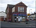
Corner shop at junction of Powell Street and Leslie Road
This looks as if it started life as a public house. The painted signs on the walls are for Butlers Ales.
Image: © John M
Taken: 1 May 2010
0.08 miles
2
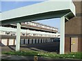
Council Housing - Flats in New Park Village
Flats built to replace properties demolished in nearby Park Village.
Image: © John M
Taken: 9 Sep 2006
0.08 miles
3
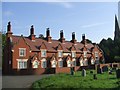
Almshouses next to Trinity Church
Recently restored almshouses in the churchyard of Trinity Church.
Image: © John M
Taken: 9 Sep 2006
0.11 miles
4
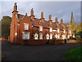
Holy Trinity Almshouses, Heath Town
Built around 1850, a terrace of 6 almshouses associated with the Image They were Grade II listed
https://britishlistedbuildings.co.uk/101201798-holy-trinity-almshouses-to-west-of-church-of-holy-trinity-heath-town-ward#.XcJ4Fej7RPY & https://historicengland.org.uk/listing/the-list/list-entry/1201798 in 1977 and rechecked in 1992, at which time they were derelict; clearly they have recently been well restored.
Image: © Richard Law
Taken: 1 Nov 2019
0.11 miles
5
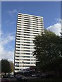
Council Housing - Brockfield House
The flats on the Heath Town Estate were opened by Princess Margaret in 1969.
Image: © John M
Taken: 13 Nov 2010
0.13 miles
6
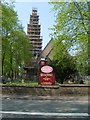
Covered Spire
Work taking place on Holy Trinity Church Heath Town.
Image: © Gordon Griffiths
Taken: 28 Apr 2007
0.14 miles
7
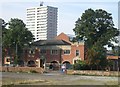
Heath Town Swimming Baths
The 1930s built swimming baths are soon to be replaced in winter of 2006 by a new leisure pool at Bentley Bridge.
Image: © John M
Taken: 9 Sep 2006
0.15 miles
8
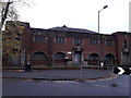
Heath Town Library and public baths
Currently disused, and looking rather sorry for itself with a few broken windows and the like to the rear, the building was erected in 1930/31 to the design of the Borough Surveyor and Engineer, HB Robinson. The library occupied the first floor above an entrance to the public baths, with a children's bath on the right and washrooms to the left. These washrooms were subsequently converted to gymnasium facilities when the place operated as Heath Town Sports and Leisure Centre, prior to its closure. It was Grade II listed https://britishlistedbuildings.co.uk/101384205-heath-town-public-baths-and-library-heath-town-ward#.XcJ1Zuj7RPY & https://historicengland.org.uk/listing/the-list/list-entry/1384205 in 2000
Image: © Richard Law
Taken: 1 Nov 2019
0.15 miles
9
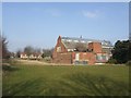
Heath Town Baths
The 1930s swimming baths is locally listed but no longer in use. The main feature is the glass roof over each pool. Changing cubicles were on balconies either side of the main pool.
This will probably be demolished soon.
Image: © John M
Taken: 16 Feb 2008
0.15 miles
10
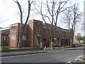
Heath Town Baths
The 1930s listed baths and library is disused awaiting demolition.
Image: © John M
Taken: 20 Feb 2009
0.16 miles