Holy Trinity Almshouses, Heath Town
Introduction
The photograph on this page of Holy Trinity Almshouses, Heath Town by Richard Law as part of the Geograph project.
The Geograph project started in 2005 with the aim of publishing, organising and preserving representative images for every square kilometre of Great Britain, Ireland and the Isle of Man.

There are currently over 7.5m images from over 14,400 individuals and you can help contribute to the project by visiting https://www.geograph.org.uk
Holy Trinity Almshouses, Heath Town
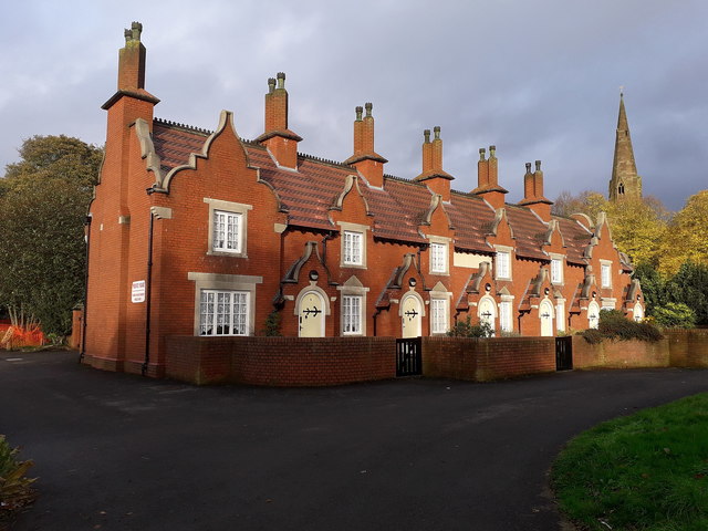
Image: © Richard Law Taken: 1 Nov 2019
Built around 1850, a terrace of 6 almshouses associated with the Image They were Grade II listed https://britishlistedbuildings.co.uk/101201798-holy-trinity-almshouses-to-west-of-church-of-holy-trinity-heath-town-ward#.XcJ4Fej7RPY & https://historicengland.org.uk/listing/the-list/list-entry/1201798 in 1977 and rechecked in 1992, at which time they were derelict; clearly they have recently been well restored.
Images are licensed for reuse under creativecommons.org/licenses/by-sa/2.0
Image Location
Latitude
52.595813
Longitude
-2.10439