IMAGES TAKEN NEAR TO
Oakenhayes Crescent, WALSALL, WS8 7QD
Introduction
This page details the photographs taken nearby to Oakenhayes Crescent, WS8 7QD by members of the Geograph project.
The Geograph project started in 2005 with the aim of publishing, organising and preserving representative images for every square kilometre of Great Britain, Ireland and the Isle of Man.

There are currently over 7.5m images from over14,400 individuals and you can help contribute to the project by visiting https://www.geograph.org.uk
Image Map
Images are licensed for reuse under creativecommons.org/licenses/by-sa/2.0
Notes
- Clicking on the map will re-center to the selected point.
- The higher the marker number, the further away the image location is from the centre of the postcode.
Image Listing (10 Images Found)
Images are licensed for reuse under creativecommons.org/licenses/by-sa/2.0
Image
Details
Distance


3

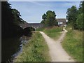
Anglesey Branch, at the end of Deakin Avenue
Between Middleton Bridge and Freeth Bridge.
Image: © Christine Johnstone
Taken: 6 May 2018
0.15 miles
4

Aqueduct on the Anglesey Branch
The Anglesey Branch of the Wyrley & Essington Canal narrows as it crosses the former Walsall - Lichfield railway.
Image: © Stephen McKay
Taken: 5 Apr 2016
0.18 miles
5

Wyrley & Essington canal
Aqueduct over trackbed of Walsall Lichfield railway
Image: © Ray Durrant
Taken: 1 Nov 2011
0.19 miles

7

Old Milepost by the A5, north of Holland Park, Brownhills
Cast iron post by the A5, in parish of WALSALL (WALSALL District), North of Holland Park, Brownhills, on grass, on South side of road. Watling Street iron T-post, erected by the Burton on Trent, Alrewas & Shenstone turnpike trust in the 19th century.
Inscription reads:- : (missing plate) : : (CHESTER 62½ / SALOP 36½) :
Milestone Society National ID: ST_CS63.
Image: © J Higgins
Taken: 1 Jan 2001
0.21 miles
8

Middleton Bridge, from the east
Carrying Chase Road over the Anglesey Branch of the Wyrley & Essington Canal.
Image: © Christine Johnstone
Taken: 6 May 2018
0.23 miles
9
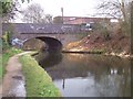
Middleton Bridge - Wyrley & Essington Canal, Anglesey Branch
Badly in need of a clean-up.
Image: © Adrian Rothery
Taken: 23 Feb 2007
0.23 miles