
IMAGES TAKEN NEAR TO
Chester Road North, WALSALL, WS8 7JB
Introduction
This page details the photographs taken nearby to Chester Road North, WS8 7JB by members of the Geograph project.
The Geograph project started in 2005 with the aim of publishing, organising and preserving representative images for every square kilometre of Great Britain, Ireland and the Isle of Man.

There are currently over 7.5m images from over14,400 individuals and you can help contribute to the project by visiting https://www.geograph.org.uk
Image Map
Images are licensed for reuse under creativecommons.org/licenses/by-sa/2.0
Notes
- Clicking on the map will re-center to the selected point.
- The higher the marker number, the further away the image location is from the centre of the postcode.
Image Listing (34 Images Found)
Images are licensed for reuse under creativecommons.org/licenses/by-sa/2.0
Image
Details
Distance
1
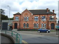
Park View Centre, Brownhills
Former home to Brownhills Urban District Council.
Image: © JThomas
Taken: 5 Oct 2013
0.06 miles
2
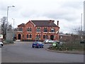
The Park View Centre
The Council House was built in 1882 and became the home of Brownhills Urban District Council which was formed in 1894. The clock has been above the building since 1911 and in 2006 it was restored to its former glory – costing £15,000.
The building spent many years boarded-up but is now a new state-of-the-art library and health centre.
Image: © Adrian Rothery
Taken: 12 Mar 2007
0.07 miles
3
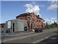
The Park View Centre
Not sure why a grey box design was chosen here for the new health centre which has been built on to the 1890s Council House.
Image: © John M
Taken: 15 Jun 2008
0.07 miles
4

Bus turning circle, The Parade, Brownhills
This turning circle, on Chester Road North (foreground) at its junction with The Parade (just out of frame to the left), sees little use as a terminus as few buses serving Brownhills terminate in the town centre (which is just beyond the roundabout on the sign). However, the bus stop is still very much in use. The trees behind it are in Holland Park, a large public park between Brownhills town centre and the A5.
Image: © Richard Vince
Taken: 5 Jun 2013
0.07 miles
5

Brownhills Station
View NE, towards Lichfield; ex-London & North Western Walsall - Lichfield (City) line, which was closed entirely on 18/1/65.
Image: © Ben Brooksbank
Taken: 3 Jun 1962
0.07 miles
6
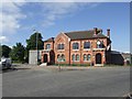
Brownhills Council House
Built in 1882 it was the home of Brownhills Urban District Council from 1894.Brownhills was absorbed into Walsall and the building lay empty for many years. It is now a community and health centre.
Image: © John M
Taken: 15 Jun 2008
0.07 miles
7
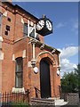
Clock at Brownhills Council House
The clock was made by WF Evans and Sons of Handsworth in 1911 and was paid for by the residue of public funds collected to celebrate the coronation of King George V. The clock was restored to working order in 2006. The building is now a library and health centre.
Image: © John M
Taken: 15 Jun 2008
0.08 miles
8
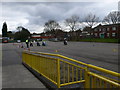
Motorcycle training
Motorcycle training at the Brownhills Activity Centre in Brownhills.
Image: © Eirian Evans
Taken: 3 Apr 2010
0.09 miles
10
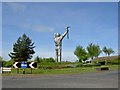
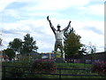
The Brownhills miner sculpture from Lichfield Road
Fantastic 13m tall stainless steel sculpture commemorating the areas coal mining history by the sculptor John McKenna ARBS, commissioned by Walsall borough council as a Gateway feature into the Black Country. Created from over 5 tons of stainless steel. For more information and a council video of the sculpture being built on site visit McKenna's website http://www.a4a.com/brownhillsminer.html
Image: © Steve Fareham
Taken: 20 May 2010
0.10 miles