
IMAGES TAKEN NEAR TO
Warren Place, WALSALL, WS8 6HF
Introduction
This page details the photographs taken nearby to Warren Place, WS8 6HF by members of the Geograph project.
The Geograph project started in 2005 with the aim of publishing, organising and preserving representative images for every square kilometre of Great Britain, Ireland and the Isle of Man.

There are currently over 7.5m images from over14,400 individuals and you can help contribute to the project by visiting https://www.geograph.org.uk
Image Map
Images are licensed for reuse under creativecommons.org/licenses/by-sa/2.0
Notes
- Clicking on the map will re-center to the selected point.
- The higher the marker number, the further away the image location is from the centre of the postcode.
Image Listing (46 Images Found)
Images are licensed for reuse under creativecommons.org/licenses/by-sa/2.0
Image
Details
Distance
1
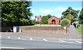
St Bernadette's Catholic Church, High Street, A452, Brownhills
The footpath, right, runs through to Warren Place.
Image: © Robin Stott
Taken: 6 Aug 2016
0.03 miles
2
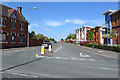
South end of Ogley Road, Brownhills
In the foreground is the High Street, A452. On the left is the closed Warrener's Arms pub.
Image: © Robin Stott
Taken: 6 Aug 2016
0.05 miles
3
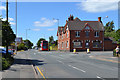
Former Warrener's Arms, corner of High Street and Ogley Road, Brownhills
The public house is shown on the earliest OS map, dated 1884. It looks more Edwardian than Victorian: rebuilt perhaps.
Image: © Robin Stott
Taken: 6 Aug 2016
0.07 miles
4
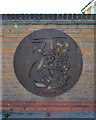
Street art: Coalminer by Thomas, High Street, Brownhills
One of a series of roundels, originally four, on a long wall opposite the Warrener's Arms in its later incarnation as a McDonald's http://members.madasafish.com/~d_hodgkinson/brownhil.htm
Image: © Robin Stott
Taken: 6 Aug 2016
0.07 miles
5
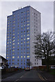
Humphries House, Brownhills
The tower block on Lindon Drive has 17 storeys and was completed in 1967.
Image: © Stephen McKay
Taken: 6 Apr 2016
0.08 miles
6
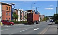
Container freight on the High Street, A452, Brownhills
In the distance the A452 becomes the Chester Road again, heading for Sutton Coldfield. Seen from the junction with Ogley Road.
Image: © Robin Stott
Taken: 6 Aug 2016
0.11 miles
7
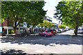
Shops and businesses set back from the High Street, A452, Brownhills
The road to the left is Silver Court Gardens.
Image: © Robin Stott
Taken: 6 Aug 2016
0.12 miles
8
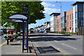
Bus stop for Warren Place, High Street A452, Brownhills
Image: © Robin Stott
Taken: 6 Aug 2016
0.13 miles
9
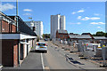
Development behind the High Street, Brownhills
It appears to be called Waterside Park and occupies much of the site of Silver Court Gardens. The blocks of flats are Humphries House and Severn House off Silver Court Gardens and Lindon Drive. The premises on the left are the backs of Image
Image: © Robin Stott
Taken: 6 Aug 2016
0.15 miles
10

Southeast on the Wyrley and Essington Canal, Brownhills
Compare Geoff Pick's Image from nine years ago in 2008.
Image: © Robin Stott
Taken: 6 Aug 2016
0.15 miles