
IMAGES TAKEN NEAR TO
Springhill Road, WALSALL, WS8 6BX
Introduction
This page details the photographs taken nearby to Springhill Road, WS8 6BX by members of the Geograph project.
The Geograph project started in 2005 with the aim of publishing, organising and preserving representative images for every square kilometre of Great Britain, Ireland and the Isle of Man.

There are currently over 7.5m images from over14,400 individuals and you can help contribute to the project by visiting https://www.geograph.org.uk
Image Map
Images are licensed for reuse under creativecommons.org/licenses/by-sa/2.0
Notes
- Clicking on the map will re-center to the selected point.
- The higher the marker number, the further away the image location is from the centre of the postcode.
Image Listing (11 Images Found)
Images are licensed for reuse under creativecommons.org/licenses/by-sa/2.0
Image
Details
Distance
1

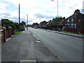
The Wyrley & Essington Canal, looking north
Between Catshill Junction and Ogley Hay Junction.
Image: © Christine Johnstone
Taken: 6 May 2018
0.10 miles
2
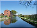
New canalside flats at Sadler's Mill, Brownhills
On the west bank of the Wyrley & Essington Canal.
Image: © Christine Johnstone
Taken: 6 May 2018
0.10 miles
5
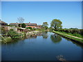
Canal forming the eastern boundary of Brownhills
Houses on Sadler Road to the west of the Wyrley & Essington Canal, fields to the right.
Image: © Christine Johnstone
Taken: 6 May 2018
0.17 miles
6
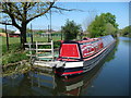
Millfield Primary School's narrowboat
Moored on a pontoon at the edge of the school's grounds. What a fortunate school, to be able to make good use of an asset on their doorstep. The boat is called Tucana. Several primary schools, including Millfield, and the Shire Oak Academy [a secondary school] form the Shire Oak Partnership.
Image: © Christine Johnstone
Taken: 6 May 2018
0.18 miles
7
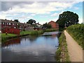
Wyrley and Essington Canal
The large building is the Ogley Hay Steam Flour Mill which was opened in 1841.
It was closed in 1942, used later for a shoe company and then metal pressing, and finally converted to flats as Saddlers Mill in 1999.
Image: © Geoff Pick
Taken: 12 Jul 2008
0.19 miles
8
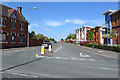
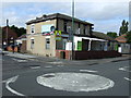
South end of Ogley Road, Brownhills
In the foreground is the High Street, A452. On the left is the closed Warrener's Arms pub.
Image: © Robin Stott
Taken: 6 Aug 2016
0.21 miles
9
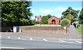
St Bernadette's Catholic Church, High Street, A452, Brownhills
The footpath, right, runs through to Warren Place.
Image: © Robin Stott
Taken: 6 Aug 2016
0.22 miles
10
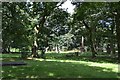
Memorials in the churchyard of St James' Church, Brownhills
The obelisk of polished pink granite commemorates members of the Roberts family in the Edwardian period.
Image: © Robin Stott
Taken: 6 Aug 2016
0.24 miles