
IMAGES TAKEN NEAR TO
Vernon Avenue, WALSALL, WS8 6AQ
Introduction
This page details the photographs taken nearby to Vernon Avenue, WS8 6AQ by members of the Geograph project.
The Geograph project started in 2005 with the aim of publishing, organising and preserving representative images for every square kilometre of Great Britain, Ireland and the Isle of Man.

There are currently over 7.5m images from over14,400 individuals and you can help contribute to the project by visiting https://www.geograph.org.uk
Image Map
Images are licensed for reuse under creativecommons.org/licenses/by-sa/2.0
Notes
- Clicking on the map will re-center to the selected point.
- The higher the marker number, the further away the image location is from the centre of the postcode.
Image Listing (19 Images Found)
Images are licensed for reuse under creativecommons.org/licenses/by-sa/2.0
Image
Details
Distance
1
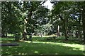
Memorials in the churchyard of St James' Church, Brownhills
The obelisk of polished pink granite commemorates members of the Roberts family in the Edwardian period.
Image: © Robin Stott
Taken: 6 Aug 2016
0.06 miles
2
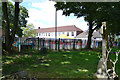
Footpath between St James' churchyard and a primary school, Brownhills
The school is on Great Charles Street.
Image: © Robin Stott
Taken: 6 Aug 2016
0.11 miles
5
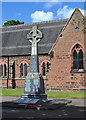
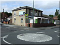
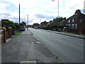
War memorial in the churchyard of St James, Brownhills
The inscription on the shaft reads "To the Glory of God and in memory of the men of Brownhills who fell in the Great War 1914-1918". The panels around the base list the fallen. In front of the base a panel lists those who fell between 1939 and 1945. All the inscriptions appear to be replacements. The church is reached from Church Road, Vicarage Road and New Road.
Image: © Robin Stott
Taken: 6 Aug 2016
0.11 miles
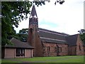
7
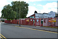
Ogley Hay Nursery School and Brownhills Children's Centre, Brickiln Street, Brownhills
Image: © Robin Stott
Taken: 6 Aug 2016
0.15 miles
8
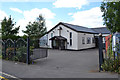
Calvary Pentecostal Church, Brickiln Street, Brownhills
Image: © Robin Stott
Taken: 6 Aug 2016
0.17 miles
9
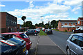
Northwest on Short Street, Brownhills
At its east end here it runs parallel to the High Street on its north side.
Image: © Robin Stott
Taken: 6 Aug 2016
0.20 miles
10
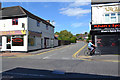
Brickiln Street meets the High Street, A452, Brownhills
The Orient is not alien in Brownhills: Chopsticks & Wok, left, Khan's Spice Restaurant, Balti and Curry Takeaway, right.
Image: © Robin Stott
Taken: 6 Aug 2016
0.22 miles