IMAGES TAKEN NEAR TO
Bramcote Way, WALSALL, WS4 1DG
Introduction
This page details the photographs taken nearby to Bramcote Way, WS4 1DG by members of the Geograph project.
The Geograph project started in 2005 with the aim of publishing, organising and preserving representative images for every square kilometre of Great Britain, Ireland and the Isle of Man.

There are currently over 7.5m images from over14,400 individuals and you can help contribute to the project by visiting https://www.geograph.org.uk
Image Map
Images are licensed for reuse under creativecommons.org/licenses/by-sa/2.0
Notes
- Clicking on the map will re-center to the selected point.
- The higher the marker number, the further away the image location is from the centre of the postcode.
Image Listing (16 Images Found)
Images are licensed for reuse under creativecommons.org/licenses/by-sa/2.0
Image
Details
Distance
1
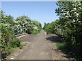
Cycle route on the old railway
National Cycle Route 5 follows the line of the former LMR line north to Pelsall and Brownhills. The line closed with the last colliery at Walsall Wood in the late 1960s.
Image: © John M
Taken: 22 May 2010
0.03 miles
2
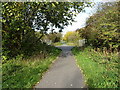
National Cycle Network Route 5 at Harden
Part of NCN Route 5, which runs from Reading to Holyhead, here passing along a stretch of disused railway just north of Walsall.
Image: © Richard Law
Taken: 24 Oct 2018
0.04 miles
3
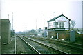
Rushall Crossing
Signalbox demolished & track lifted but trackbed preserved.Will the railway ever return?
Image: © Ray Durrant
Taken: 11 Apr 1984
0.08 miles
4
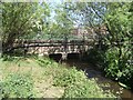
Culvert on tributary of the Ford Brook
The Ford Brook rises in the Clayhanger/Brownhills area and flows through the centre of Walsall to join the River Tame at Bescot. The fast flowing tributary carries the outflow from the water treatment works at Goscote as is evident from the smell and soap bubbles.
Image: © John M
Taken: 22 May 2010
0.10 miles
5
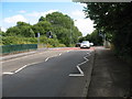
Pedestrian Crossing, Station Road
The railway originally crossed the road here but now the crossing allows cyclists using the cycle path to do the same.
Image: © Adrian Rothery
Taken: 1 Aug 2008
0.10 miles
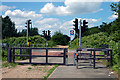
7
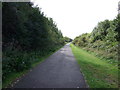
Cycle track on disused railway
Heading south.
Image: © JThomas
Taken: 5 Oct 2013
0.11 miles
9
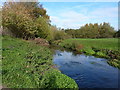
The Ford Brook
Rising a little way to the NE of here, in the area to the south of Brownhills, the Ford Brook runs through the middle of Walsall (presumably much culverted now) to join the Tame not far from Bescot.
Image: © Richard Law
Taken: 24 Oct 2018
0.16 miles