IMAGES TAKEN NEAR TO
Lodge Road, WALSALL, WS4 1DE
Introduction
This page details the photographs taken nearby to Lodge Road, WS4 1DE by members of the Geograph project.
The Geograph project started in 2005 with the aim of publishing, organising and preserving representative images for every square kilometre of Great Britain, Ireland and the Isle of Man.

There are currently over 7.5m images from over14,400 individuals and you can help contribute to the project by visiting https://www.geograph.org.uk
Image Map
Images are licensed for reuse under creativecommons.org/licenses/by-sa/2.0
Notes
- Clicking on the map will re-center to the selected point.
- The higher the marker number, the further away the image location is from the centre of the postcode.
Image Listing (7 Images Found)
Images are licensed for reuse under creativecommons.org/licenses/by-sa/2.0
Image
Details
Distance
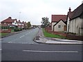
2
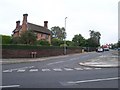
Birch Lane
The popular 'Farm Shop' on the corner.
Image: © Adrian Rothery
Taken: 13 Oct 2006
0.10 miles
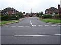
5

Willows Road
The view on the road off the A461 in Pelsall.
Image: © Gordon Griffiths
Taken: 4 May 2013
0.22 miles
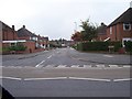
7
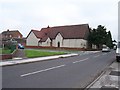
Broad Lane
Junction of Broad Lane and Mill Road.
Image: © Adrian Rothery
Taken: 13 Oct 2006
0.24 miles