
IMAGES TAKEN NEAR TO
Lothians Road, WALSALL, WS3 4HF
Introduction
This page details the photographs taken nearby to Lothians Road, WS3 4HF by members of the Geograph project.
The Geograph project started in 2005 with the aim of publishing, organising and preserving representative images for every square kilometre of Great Britain, Ireland and the Isle of Man.

There are currently over 7.5m images from over14,400 individuals and you can help contribute to the project by visiting https://www.geograph.org.uk
Image Map
Images are licensed for reuse under creativecommons.org/licenses/by-sa/2.0
Notes
- Clicking on the map will re-center to the selected point.
- The higher the marker number, the further away the image location is from the centre of the postcode.
Image Listing (17 Images Found)
Images are licensed for reuse under creativecommons.org/licenses/by-sa/2.0
Image
Details
Distance
1
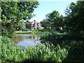
Moat Farm Pool
Beside the Lichfield Road at the Fingerpost.
Image: © John M
Taken: 10 Jun 2008
0.09 miles
2
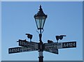
The Fingerpost, Pelsall Wood
A local landmark on the Wolverhampton to Lichfield Road.
Image: © John M
Taken: 10 Jun 2008
0.09 miles
3

Direction Sign - Signpost by the A4124, Lichfield Road, Brownhills parish
Lamp finial - 4 arms; Walsall taper by the A4124, in parish of Brownhills (Walsall District), in Pelsall, on a triangular island on the northeast side of the junction of the A4124 Lichfield Road and B4155 Norton Road.
Wolverhampton and Walsall HER.
HER Number: 9495 https://www.heritagegateway.org.uk/Gateway/Results_Single.aspx?uid=MBL2375&resourceID=1025
Surveyed
Milestone Society National ID: ST_SK0204B
Image: © M Faherty
Taken: 30 Jun 2013
0.09 miles
4
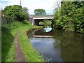
Yorks Foundry Bridge
Carries the A4124 Lichfield Road over the Wyrley and Essington Canal.
Image: © Adrian Rothery
Taken: 22 May 2007
0.09 miles
5
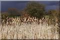
Wyrley & Essington Canal, Pelsall
The remains of an old arm are totally choked with reeds close to York's Foundry Bridge. The sky here looks distinctly threatening.
Image: © Stephen McKay
Taken: 6 Apr 2016
0.10 miles
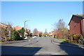
7
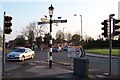
The Fingerpost
A well-known landmark at the top end of Pelsall, at the junction of the A4124 and B4154.
Image: © Adrian Bailey
Taken: 21 Apr 2005
0.16 miles
8
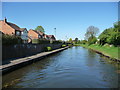
Waters View, Highbridge
'Waters View' is the name of the canalside street. The water residents can see is the Wyrley & Essington Canal.
Image: © Christine Johnstone
Taken: 6 May 2018
0.17 miles
9
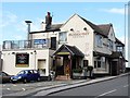
The Fingerpost Pub
This pub, adjacent to Yorks Bridge on the Wyrley and Essington Canal, is close to two fingerposts - one at a nearby road junction and one at Pelsall Canal Junction.
Image: © Mike W Hallett
Taken: 11 Sep 2010
0.17 miles
10
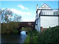
Yorks Bridge, Pelsall
The pub was called the Royal Oak but has now been renamed as 'The Fingerpost'.
Image: © Geoff Pick
Taken: 21 Oct 2006
0.19 miles