
IMAGES TAKEN NEAR TO
Hollingworth Mews, CANNOCK, WS11 0GS
Introduction
This page details the photographs taken nearby to Hollingworth Mews, WS11 0GS by members of the Geograph project.
The Geograph project started in 2005 with the aim of publishing, organising and preserving representative images for every square kilometre of Great Britain, Ireland and the Isle of Man.

There are currently over 7.5m images from over14,400 individuals and you can help contribute to the project by visiting https://www.geograph.org.uk
Image Map
Images are licensed for reuse under creativecommons.org/licenses/by-sa/2.0
Notes
- Clicking on the map will re-center to the selected point.
- The higher the marker number, the further away the image location is from the centre of the postcode.
Image Listing (24 Images Found)
Images are licensed for reuse under creativecommons.org/licenses/by-sa/2.0
Image
Details
Distance
1
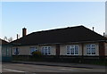
Pair of prefabricated cottages on Watling Street
Image: © Eirian Evans
Taken: 26 Mar 2010
0.10 miles
2
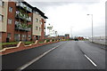
Lakeside Boulevard, Bridgtown
This is one of the new complexes being built around Walkmill lane.
Image: © Mick Malpass
Taken: 17 Jun 2011
0.11 miles
3
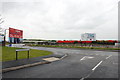
Brownfield Site, Walkmill Lane
This part of Bridgtown has altered beyond recognition in the past few years, how long before this site is covered with Offices etc.
Image: © Mick Malpass
Taken: 17 Jun 2011
0.12 miles
4
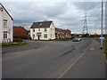
Housing on Lakeside Boulevard, Bridgtown, Cannock
A recent development of homes on the south side of the A5, hemmed in to the south by the M6 Toll road.
Image: © Richard Law
Taken: 5 Mar 2014
0.14 miles
5
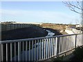
Brook near M6 Toll, Lakeside Plaza
Diverted as part of the M6 Toll works the brook is now hemmed in by the recent ice rink, leisure and office development adjacent to the new road.
Image: © John M
Taken: 6 Jan 2008
0.15 miles
6
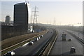
Rush hour on the M6 Toll
While the M6 is clogged with traffic in the morning rush hour, there are few vehicles on the M6 Toll as few wish to pay to use it.
Image: © Derek Bennett
Taken: 3 Mar 2014
0.15 miles
8
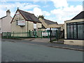
Church Street school, Bridgtown
The remains of the former school in Church Street, Bridgtown. Now used as the premises of a glass & glazing firm, whose address is given as "The Old Schoolhouse', it was first established in 1874 and belonged to the church about 30 yards off-shot to the right. Initially there were about 90 pupils, a roll which grew to 130 in 1891. Management of the school transferred to the Church of England board in 1951, and it eventually closed in 1960.
Image: © Richard Law
Taken: 13 Aug 2014
0.18 miles
9
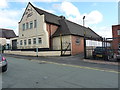
Former St Paul's Church, Bridgtown
In 1874, an iron church of St Paul stood on this site, along with the former school (just visible on the left); the iron building was replaced by this brick-and-stone construction in 1899, and the rendered & painted frontage has been added more recently, hiding or removing an OS flush bracket that used to reside there. No longer consecrated, it is now a business premises.
Image: © Richard Law
Taken: 13 Aug 2014
0.19 miles
10
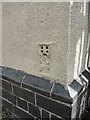
OS Flush Bracket - Bridgtown school
Flush bracket S1416 on the former school on Church Street; originally levelled at 123.139m above Ordnance Datum Newlyn. There used to be another on the former church more or less next door too, but this seems to have gone for a burton.
Image: © Richard Law
Taken: 13 Aug 2014
0.19 miles