OS Flush Bracket - Bridgtown school
Introduction
The photograph on this page of OS Flush Bracket - Bridgtown school by Richard Law as part of the Geograph project.
The Geograph project started in 2005 with the aim of publishing, organising and preserving representative images for every square kilometre of Great Britain, Ireland and the Isle of Man.

There are currently over 7.5m images from over 14,400 individuals and you can help contribute to the project by visiting https://www.geograph.org.uk
OS Flush Bracket - Bridgtown school
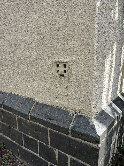
Image: © Richard Law Taken: 13 Aug 2014
Flush bracket S1416 on the former school on Church Street; originally levelled at 123.139m above Ordnance Datum Newlyn. There used to be another on the former church more or less next door too, but this seems to have gone for a burton.
Images are licensed for reuse under creativecommons.org/licenses/by-sa/2.0
Image Location
Latitude
52.675837
Longitude
-2.03143