Former St Paul's Church, Bridgtown
Introduction
The photograph on this page of Former St Paul's Church, Bridgtown by Richard Law as part of the Geograph project.
The Geograph project started in 2005 with the aim of publishing, organising and preserving representative images for every square kilometre of Great Britain, Ireland and the Isle of Man.

There are currently over 7.5m images from over 14,400 individuals and you can help contribute to the project by visiting https://www.geograph.org.uk
Former St Paul's Church, Bridgtown
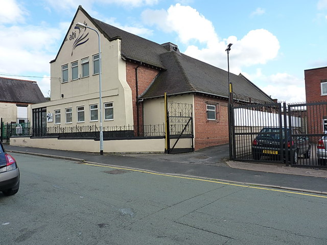
Image: © Richard Law Taken: 13 Aug 2014
In 1874, an iron church of St Paul stood on this site, along with the former school (just visible on the left); the iron building was replaced by this brick-and-stone construction in 1899, and the rendered & painted frontage has been added more recently, hiding or removing an OS flush bracket that used to reside there. No longer consecrated, it is now a business premises.
Images are licensed for reuse under creativecommons.org/licenses/by-sa/2.0
Image Location
Latitude
52.675729
Longitude
-2.031903