
IMAGES TAKEN NEAR TO
Teme Crescent, DROITWICH, WR9 8UB
Introduction
This page details the photographs taken nearby to Teme Crescent, WR9 8UB by members of the Geograph project.
The Geograph project started in 2005 with the aim of publishing, organising and preserving representative images for every square kilometre of Great Britain, Ireland and the Isle of Man.

There are currently over 7.5m images from over14,400 individuals and you can help contribute to the project by visiting https://www.geograph.org.uk
Image Map
Images are licensed for reuse under creativecommons.org/licenses/by-sa/2.0
Notes
- Clicking on the map will re-center to the selected point.
- The higher the marker number, the further away the image location is from the centre of the postcode.
Image Listing (29 Images Found)
Images are licensed for reuse under creativecommons.org/licenses/by-sa/2.0
Image
Details
Distance
1
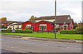
Pillar of Salt (1), Celvestune Way, Copcutt Hill, Droitwich Spa
A large modern estate pub on the Copcutt Hill Estate, which has a lot of activities going on. It is one of the six Marston's pubs currently in the town. Rather oddly, it seems to be gradually changing colour. When photographed by Peter Whatley in March 2010 only two doors were in red. See:- Image Another photograph, not on this site, shows part of the front painted red, but by the time I came to take my photograph, in November 2012, the red area had extended even further, but there are still large areas that haven't gone red. A task for 2013 perhaps?
Image
Image: © P L Chadwick
Taken: 3 Nov 2012
0.03 miles
2
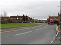
Droitwich Spa - Celvestune Way, Copcut
One of several housing estate spine roads south and east of the old town.
Image: © Peter Whatley
Taken: 23 Mar 2010
0.03 miles
3
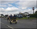
Horse and Traps on Celvestune Way, Droitwich
Image: © Jeff Gogarty
Taken: 15 Apr 2023
0.04 miles
4
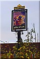
Pillar of Salt (2) - sign, Celvestune Way, Copcutt Hill, Droitwich Spa
The pub's sign is on a post at the edge of the car park. The town has a long association with salt, as it sits on very large deposits. The Romans were extracting it almost two thousand years ago, but it was being extracted long before their arrival. The pub's name and sign seem to refer to the pillar of salt into which Lot's wife was transformed in the Biblical account of the destruction of Sodom and Gomorrah. Quite what this has got to do with salt extraction in Droitwich is unknown!
Image
Image: © P L Chadwick
Taken: 3 Nov 2012
0.05 miles
5
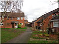
Houses on Celvestune Way, Copcut, Droitwich
The path provides a more direct route to Old Coach Road and the local schools than the loop of the road.
Image: © Jeff Gogarty
Taken: 26 Dec 2015
0.06 miles
6
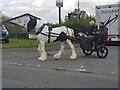
Horse and trap leaving the Pillar of Salt car park, Droitwich
Image: © Jeff Gogarty
Taken: 15 Apr 2023
0.06 miles
7
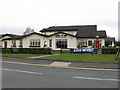
Pillar Of Salt Public House
A modern establishment to complement the extensive housing estates which surround it.
Image: © Peter Whatley
Taken: 23 Mar 2010
0.08 miles
8
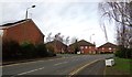
Copcut Court, Droitwich
Copcut Court is sheltered housing on Waveney Road. This is showing the rear on the junction of Thames Drive and Celvestune Way. Waveney Road is off of Thames Drive.
Image: © Jeff Gogarty
Taken: 26 Dec 2015
0.08 miles
9
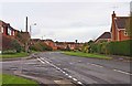
Celvestune Way, Copcutt Hill, Droitwich Spa
A major road running through the Copcutt Hill Estate.
Image: © P L Chadwick
Taken: 3 Nov 2012
0.09 miles
10
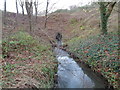
Copcut Stream, Droitwich disappearing into a culvert
The culvert takes in under the A38 (Roman Way) and it used to reappear flowing through allotments but the other side of Roman Way is being developed for housing and I do not know how far this extends.
Image: © Jeff Gogarty
Taken: 26 Dec 2015
0.11 miles