1
The former St John's Hospital, Droitwich
Now a nursing home and originally a workhouse. For many years it was the annexe to the Highfields Hospital - a tertiary referral centre for rheumatology patients from around the country. Two hospitals have retrenched to a handful of beds in the Highfield Unit at Worcestershire Royal Hospital.
Image: © Chris Allen
Taken: 22 Feb 2009
0.10 miles
2
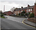
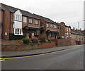
Row of houses, St Peter's Walk, Droitwich
Viewed across the road named The Holloway.
Image: © Jaggery
Taken: 16 Nov 2016
0.11 miles
3
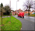
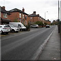
Charles Henry Road, Droitwich
The northwest end of Charles Henry Road, at the junction with The Holloway.
Charles Henry Road extends for 400 metres from here to Winslow Avenue.
The red Royal Mail Fiat Doblo van has the identifier D3.
Image: © Jaggery
Taken: 16 Nov 2016
0.11 miles
4
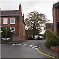
Heriotts Lane, Droitwich
On the west side of The Holloway and St Peter's Walk,
Heriotts Lane leads to Heriotts Court and St George's Crescent.
Image: © Jaggery
Taken: 16 Nov 2016
0.13 miles
5
Royal Mail van, Charles Henry Road, Droitwich
The red Royal Mail Fiat Doblo van, identifier D3, is parked while a postman,
seen on the left here, http://www.geograph.org.uk/photo/5196669 is walking a delivery route.
Image: © Jaggery
Taken: 16 Nov 2016
0.14 miles
6
Handy florists for the funeral
Crump's family business on Hanbury Road, Droitwich.
Image: © Jeff Gogarty
Taken: 23 Aug 2020
0.14 miles
7
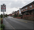
Warning sign - elderly people, The Holloway, Droitwich
The sign near the corner of Charles Henry Road and The Holloway warns
motorists that slow-moving elderly people may be crossing the road in this area.
Image: © Jaggery
Taken: 16 Nov 2016
0.14 miles
8
Corbett Veterinery Clinic, 36 Hanbury Road, Droitwich
The clinic is operated by the practice of MacArthur Barstow & Gibbs, which has evolved from a practice set up by Frank Moody in Corbett Avenue in Droitwich in 1956.
Image: © P L Chadwick
Taken: 2 Jul 2011
0.14 miles
9
West side of The Holloway, Droitwich
Modern houses are on the left. The 17th century Coventry Hospital almshouses http://www.geograph.org.uk/photo/5196736 are on the right.
Image: © Jaggery
Taken: 16 Nov 2016
0.14 miles
10
Up The Holloway, Droitwich
The Holloway ascends to the SSE away from the B4090. The Ring O' Bells pub is on the left. http://www.geograph.org.uk/photo/5196358
Image: © Jaggery
Taken: 16 Nov 2016
0.14 miles


