
IMAGES TAKEN NEAR TO
Woodfields, DROITWICH, WR9 8NF
Introduction
This page details the photographs taken nearby to Woodfields, WR9 8NF by members of the Geograph project.
The Geograph project started in 2005 with the aim of publishing, organising and preserving representative images for every square kilometre of Great Britain, Ireland and the Isle of Man.

There are currently over 7.5m images from over14,400 individuals and you can help contribute to the project by visiting https://www.geograph.org.uk
Image Map
Images are licensed for reuse under creativecommons.org/licenses/by-sa/2.0
Notes
- Clicking on the map will re-center to the selected point.
- The higher the marker number, the further away the image location is from the centre of the postcode.
Image Listing (226 Images Found)
Images are licensed for reuse under creativecommons.org/licenses/by-sa/2.0
Image
Details
Distance
2
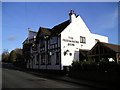
The Freemasons Arms Pub, Droitwich
Bromsgrove Road, Hill End, Droitwich, WR9 8LZ close to the Droitwich Junction Canal
Image: © canalandriversidepubs co uk
Taken: 5 Feb 2010
0.05 miles
3
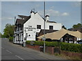
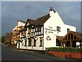
The Freemasons Arms, Droitwich
I am not sure if I have ever been in this public house.
Image: © Chris Allen
Taken: 30 Apr 2022
0.06 miles
4
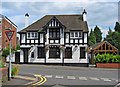
The Freemasons Arms (1), Bromsgrove Road
A popular pub opposite Church Lane.
Image
Image: © P L Chadwick
Taken: 15 Jun 2010
0.06 miles
5
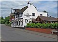
The Freemasons Arms (2), Bromsgrove Road
Another view:- Image
Image: © P L Chadwick
Taken: 15 Jun 2010
0.06 miles
6
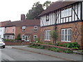
Houses at Bromsgrove Road, Driotwich
At the bottom of Crutch Lane whose start can be seen. The neares house has a plaque saying 1878 and showing the Corbet(t) Raven.
Image: © Jeff Gogarty
Taken: 1 Sep 2016
0.06 miles
8
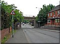
Bromsgrove Road and railway bridge
There is still a railway line in use running over this bridge.
Image: © P L Chadwick
Taken: 15 Jun 2010
0.07 miles
9
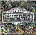
Old Milestone by the B4065, Bromsgrove Road, Droitwich Spa Parish
Metal plate attached to concrete post by the B4065 (was A38), in parish of DROITWICH SPA (WYCHAVON District), Bromsgrove Road, Hill End, North of Dodderhill Road junction, on hedge bank, on South East side of road. Bradley post, erected by the County Council in the 20th century.
Inscription reads:-
A38
WORCESTER 7
19 BIRMINGHAM
C.C.W.
Milestone Society National ID: WO_WOBM07.
Image: © J Higgins
Taken: 17 Jan 2012
0.08 miles
10
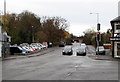
Bromsgrove Road towards a railway bridge, Droitwich
The B4065 Bromsgrove Road NE of the crossroads at the Queen Street, Saltway and Hanbury Street junctions.
Image: © Jaggery
Taken: 16 Nov 2016
0.10 miles