IMAGES TAKEN NEAR TO
High Park, Ombersley Road, DROITWICH, WR9 0AG
Introduction
This page details the photographs taken nearby to High Park, Ombersley Road, WR9 0AG by members of the Geograph project.
The Geograph project started in 2005 with the aim of publishing, organising and preserving representative images for every square kilometre of Great Britain, Ireland and the Isle of Man.

There are currently over 7.5m images from over14,400 individuals and you can help contribute to the project by visiting https://www.geograph.org.uk
Image Map
Images are licensed for reuse under creativecommons.org/licenses/by-sa/2.0
Notes
- Clicking on the map will re-center to the selected point.
- The higher the marker number, the further away the image location is from the centre of the postcode.
Image Listing (12 Images Found)
Images are licensed for reuse under creativecommons.org/licenses/by-sa/2.0
Image
Details
Distance
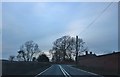
1
High Park near Droitwich
View from edge of Salwarpe
Image: © Jeff Gogarty
Taken: 18 Jul 2010
0.05 miles
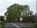
3
View East From Westwood Park Farm's Entrance
Image: © Peter Whatley
Taken: 23 Mar 2010
0.13 miles
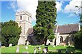
4
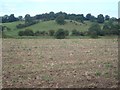
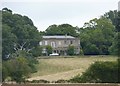
High Park Hill
From the footpath, looking across harrowed stubble to High Park house, which is just visible to the left of the trees. The Droitwich Barge Canal runs along the far edge of this field.
Image: © Trevor Rickard
Taken: 7 Sep 2007
0.16 miles
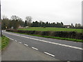
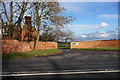
6
Westwood Park entrance
The wall of the estate runs alongside the A4133 for several hundred yards
Image: © David Smith
Taken: 20 May 2013
0.19 miles
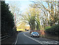
8
Westwood Park entrance.
Entrance (off the A4133 Droitwich - Ombersley Road) to the estate via Westwood Farm.
Image: © Mike Dodman
Taken: 16 Jan 2009
0.20 miles
9
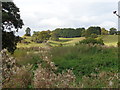
View across the reed bed to High Park
The Coney Meadow reed bed, which lies on the banks of the Droitwich Barge canal, was home to a variety of species of birds, reptiles and mammals, until a tragic blaze early in 2015, which saw 30 foot high flames sweep through the reserve, leaving 75 per cent destroyed. Restoration is in progress by the Canal and River Trust.
Image: © Jeff Gogarty
Taken: 23 Oct 2016
0.21 miles
10
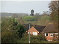
High Park, Salwarpe, Droitwich
The high ground in the distance in High Park. Photograph taken from Silverdale, Droitwich. The House in the foreground are in Westbury Avenue.
Image: © Jeff Gogarty
Taken: 26 Dec 2015
0.22 miles