
IMAGES TAKEN NEAR TO
Chase End Close, WORCESTER, WR5 2BY
Introduction
This page details the photographs taken nearby to Chase End Close, WR5 2BY by members of the Geograph project.
The Geograph project started in 2005 with the aim of publishing, organising and preserving representative images for every square kilometre of Great Britain, Ireland and the Isle of Man.

There are currently over 7.5m images from over14,400 individuals and you can help contribute to the project by visiting https://www.geograph.org.uk
Image Map
Images are licensed for reuse under creativecommons.org/licenses/by-sa/2.0
Notes
- Clicking on the map will re-center to the selected point.
- The higher the marker number, the further away the image location is from the centre of the postcode.
Image Listing (20 Images Found)
Images are licensed for reuse under creativecommons.org/licenses/by-sa/2.0
Image
Details
Distance
1
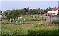
Allotments at the end of Foxwell Street Worcester
The railway from Bristol and London passes in a cutting behind the bushes on its way to Shrub Hill station about a mile to the right.
Image: © Andrew Darge
Taken: 9 Jun 2005
0.04 miles
2
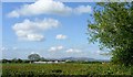
Malvern view from the track up to Red Hill
This track would once have been the way down from London road to the farm at Battenhall now converted to houses and accessed from Battenhall road under the railway . The track is well used by school children from the St.Peters estate attending the Nunnery Wood High School and the Sixth Form College and has recently been resurfaced though not for motor traffic.
Image: © Andrew Darge
Taken: 3 May 2010
0.04 miles
3
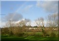
Battenhall ridge
This run of housing occupies the base of a slight ridge above the flood plain of the duck brook . St Mary's convent school is in the big house on the hill.
Image: © Andrew Darge
Taken: 23 Nov 2008
0.16 miles
4
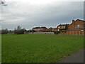
Grassy area and the rear of Battenhall Rise, Worcester
A grassy space between the older housing stock of Battenhall and the newer development of St Peter the Great (out of sight to the left).
Image: © Chris Allen
Taken: 8 Jan 2020
0.17 miles
5
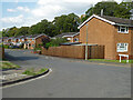
Arundel Drive, Worcester
From Battenhall Avenue
Image: © Chris Allen
Taken: 4 Sep 2021
0.17 miles
6
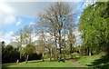
Cromwell Crescent park
A delightful park with woodland, grassy play area and a kiddies' playground tucked away just off the London Road south of the city.
Image: © Andrew Darge
Taken: 13 Apr 2012
0.18 miles
7
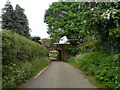
Pipeline beneath the railway
This accommodation bridge gave the engineers a way under the railway with a minimum of disruption.
Image: © Andrew Darge
Taken: 19 May 2008
0.18 miles
8
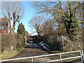
Passage under the railway
The western side of this old accommodation bridge that also serves as a way for the oil pipeline installed in the war as part of the secret network that brought bulk supplies from refineries near Liverpool down to the south and thence to the Normandy beach head via PLUTO (Pipeline Under The Ocean )
Image: © Andrew Darge
Taken: 20 Feb 2010
0.19 miles
9
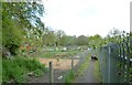
Allotment gardens in Battenhall
A little gem of an allotment site between the railway and fairly modern housing in Battenhall.
Image: © Andrew Darge
Taken: 8 May 2012
0.19 miles
10
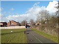
Street furniture at Battenhall
The excellent system of paths and cycle tracks around the St Peter's estate south of Worcester are now enhanced with very descriptive blue metal finger posts, the dog waste bins have been around sometime and are well used. This is the junction at the end of Battenhall road. Here the oil pipeline crosses left to right and under the railway.
Image: © Andrew Darge
Taken: 20 Feb 2010
0.21 miles