IMAGES TAKEN NEAR TO
Mulberry Terrace, WORCESTER, WR4 9EY
Introduction
This page details the photographs taken nearby to Mulberry Terrace, WR4 9EY by members of the Geograph project.
The Geograph project started in 2005 with the aim of publishing, organising and preserving representative images for every square kilometre of Great Britain, Ireland and the Isle of Man.

There are currently over 7.5m images from over14,400 individuals and you can help contribute to the project by visiting https://www.geograph.org.uk
Image Map
Images are licensed for reuse under creativecommons.org/licenses/by-sa/2.0
Notes
- Clicking on the map will re-center to the selected point.
- The higher the marker number, the further away the image location is from the centre of the postcode.
Image Listing (48 Images Found)
Images are licensed for reuse under creativecommons.org/licenses/by-sa/2.0
Image
Details
Distance
1
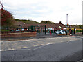
Hollymount School, Worcester
In the Tolladine area. This is a mainstream state funded junior school. It is graded good by Ofsted and the reading standard is better than average.
I had walked past earlier in better lighting but it was near home time and there were too many people around so that I wouldn't have felt comfortable taking a photograph. Gorse Hill is seen behind.
Image: © Chris Allen
Taken: 3 Nov 2021
0.04 miles
2
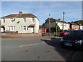
Birch Avenue, Worcester
These appear to have been built as council housing stock.
Image: © Chris Allen
Taken: 25 Oct 2022
0.06 miles
3
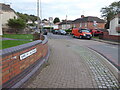
Birch Avenue, Worcester
Seen from Holly Mount. The housing has the appearance of council houses.
Image: © Chris Allen
Taken: 3 Nov 2021
0.07 miles
4
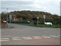
Junction of Tunnel Hill and Laurel Road, Worcester
Laurel Road leads out of sight to the left and Tunnel Hill is straight ahead and also to the right behind the photographer. The green railings are delimiting the playing fields of Gorse Hill Community Primary School. The woods beyond cover Gorse Hill.
Image: © Chris Allen
Taken: 6 Mar 2021
0.08 miles
7
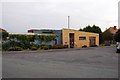
The Tolly Centre, Rowan Avenue, Tolladine, Worcester
Located on the corner of Rose Avenue and Rowan Avenue, the Tolly Centre is a community centre which used to be known as the Tolladine Community Centre. It is run by Worcester Community Trust, a registered charity, and is one of seven community centres in the City of Worcester run by them. This centre has a meeting room and a large hall and as one would expect there are a lot of community activities based here. The building dates from 2005-6 to a design by Meadowcroft Griffin Architects.
Tolladine is a residential suburb of Worcester some way to the northeast of the city centre and a world away from what interests the city's many tourists. At present the area gives the impression of being rather run down, with the Tolly Centre being one of the few amenities the area seems to possess.
Image: © P L Chadwick
Taken: 6 Sep 2014
0.10 miles
8
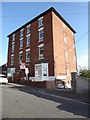
High Point and High View, Tunnel Hill
Two tall and prominent semidetached properties that I think may now be apartments. These are visible from a quite a wide area including Newtown Road and Shrub Hill Station.
Image: © Chris Allen
Taken: 26 Sep 2019
0.10 miles
9
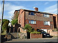
Path from Holly Mount to Tunnel Hill, Worcester
A length of public footpath leading towards two houses that are very prominent in Worcester, being both tall in themselves and at a high point.
Image: © Chris Allen
Taken: 26 Sep 2019
0.10 miles