
IMAGES TAKEN NEAR TO
Holland Green, WORCESTER, WR4 0NG
Introduction
This page details the photographs taken nearby to Holland Green, WR4 0NG by members of the Geograph project.
The Geograph project started in 2005 with the aim of publishing, organising and preserving representative images for every square kilometre of Great Britain, Ireland and the Isle of Man.

There are currently over 7.5m images from over14,400 individuals and you can help contribute to the project by visiting https://www.geograph.org.uk
Image Map
Images are licensed for reuse under creativecommons.org/licenses/by-sa/2.0
Notes
- Clicking on the map will re-center to the selected point.
- The higher the marker number, the further away the image location is from the centre of the postcode.
Image Listing (139 Images Found)
Images are licensed for reuse under creativecommons.org/licenses/by-sa/2.0
Image
Details
Distance
2
Dugdale Drive in the Harleys, Warndon Villages
Harley Bakewell to the right and Harley Whitefort to the left. The next left is Bright Avenue. In the distance the large road sign indicates the roundabout on the A4440. It was very dull and slightly misty Sunday afternoon.
Image: © Chris Allen
Taken: 24 Nov 2019
0.04 miles
3
Fowler Avenue, Harley-Bakewell across Dugdale drive
Fowler Avenue is the entrance to Harley Bakewell. Some of the Warndon Villages have more than one road entrance but this one doesn't. Dugdale Drive bisects the Harleys and leads to the A4440 Worcester bypass.
Image: © Chris Allen
Taken: 24 Nov 2019
0.04 miles
4
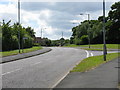
One of the Harleys
This corner of Warndon Villages is made up of a series of estates prefixed with 'Harley'. Bright Avenue is part of Harley-Whitefort. New building is going on between Bright Avenue and the bypass road that can be seen crossing the distant roundabout. There are passable footpaths above and below the new build with one coming off Bright Avenue just out of shot to the left.
Image: © Chris Allen
Taken: 24 Apr 2010
0.05 miles
6
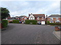
Cobden Avenue, Harley-Whitefort
Seen from Bright Avenue. Cobden Avenue passes across the end of Bright avenue at a T-junction. Cobden Avenue is a long sinuous road from which various other streets fork off within Harley-Whitefort.
Image: © Chris Allen
Taken: 22 Dec 2019
0.06 miles
7

Public footpath between Harley Whitefort and Mabbs Close
Part of Warndon Villages housing development.
Image: © Chris Allen
Taken: 2 May 2021
0.07 miles
8
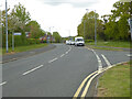
Dugdale Drive, Warndon Villages, worcester
The sign on the left points into Bright Avenue into Harley Whitefort.
Image: © Chris Allen
Taken: 2 May 2021
0.07 miles
9
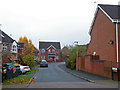
Key Avenue, Harley-Bakewell
Seen from Fowler Avenue
Image: © Chris Allen
Taken: 24 Nov 2019
0.07 miles
10
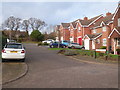
Sheridan Row, Harley-Bakewell
Seen from Lister Avenue. Part of the large complex known as Warndon Villages. The Harleys are one of four groups of 'villages' and Bakewell is one of several groups of streets within the Harleys. Each individual sub-area is isolated from its neighbours if you are in a vehicle but they interconnect if you are on foot or bicycle.
Image: © Chris Allen
Taken: 22 Dec 2019
0.07 miles