IMAGES TAKEN NEAR TO
Bromyard Road, TENBURY WELLS, WR15 8RU
Introduction
This page details the photographs taken nearby to Bromyard Road, WR15 8RU by members of the Geograph project.
The Geograph project started in 2005 with the aim of publishing, organising and preserving representative images for every square kilometre of Great Britain, Ireland and the Isle of Man.

There are currently over 7.5m images from over14,400 individuals and you can help contribute to the project by visiting https://www.geograph.org.uk
Image Map
Images are licensed for reuse under creativecommons.org/licenses/by-sa/2.0
Notes
- Clicking on the map will re-center to the selected point.
- The higher the marker number, the further away the image location is from the centre of the postcode.
Image Listing (13 Images Found)
Images are licensed for reuse under creativecommons.org/licenses/by-sa/2.0
Image
Details
Distance
1
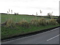
Pampas Grass & Fields Alongside The B4214
Image: © Peter Whatley
Taken: 10 Feb 2010
0.12 miles
3
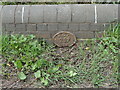
Old Bridge Marker on the B4214 near Grithill Farm
Bridge Marker fixed to the west parapet of an unnamed bridge near Grithill Farm on the B4214 over Netherwood Brook in Collington parish. The bridge links Collington, Herefordshire and Stoke Bliss, Worcestershire. There is no corresponding marker on the Worcestershire side. BS (boundary stone) is shown on OS maps, which might have prevented arguments between County Council teams, but it could not be found.
Milestone Society National ID: HF_COLLIN01br
Image: © Roadside Relics
Taken: 20 Apr 2022
0.13 miles
4
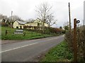
B4214
Stoke Bliss, Worcestershire is a scattered community and the sign is a parish boundary notification. There is no village on the road here. The church is high up to the northeast.
Image
Image: © Richard Webb
Taken: 6 Apr 2014
0.13 miles
5
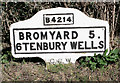
Old Milestone by the B4214, opposite Grithill Farm
Metal plates attached to concrete post by the B4214, in parish of STOKE BLISS (MALVERN HILLS District), opposite lane to Grithill Farm, 30 yards from county boundary, in hedge, on East side of road. Bradley post, erected by the County Council in the 20th century.
Inscription reads:-
B4214
BROMYARD 5.
6 TENBURY WELLS
C.C.W.
Milestone Society National ID: WO_TBBY06.
Image: © J Higgins
Taken: 1 Apr 2007
0.14 miles
6
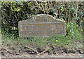
Old Milestone by the B4214, opposite Grithill Farm
Metal plates attached to concrete post by the B4214, in parish of STOKE BLISS (MALVERN HILLS District), opposite lane to Grithill Farm, 30 yards from county boundary, in hedge, on East side of road. Bradley post, erected by the County Council in the 20th century.
Inscription reads:-
B4214
BROMYARD 5.
6 TENBURY WELLS
C.C.W.
Milestone Society National ID: WO_TBBY06.
Image: © Roadside Relics
Taken: 20 Apr 2022
0.14 miles
7
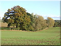
Herefordshire-Worcestershire border
This autumnal view shows a row of trees on a hedgerow that divides the two counties. The camera and field is in Herefordshire, Worcestershire being the field behind the oak trees.
Image: © Jonathan Billinger
Taken: 17 Oct 2007
0.15 miles
8
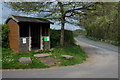
Bus shelter on the B4214 near Pie Corner
Image: © Philip Halling
Taken: 21 Apr 2007
0.16 miles
9
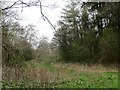
Path, headwaters of the Kyre Brook
Looking along the Herefordshire / Worcestershire march.
Image: © Richard Webb
Taken: 6 Apr 2014
0.17 miles