Old Milestone by the B4214, opposite Grithill Farm
Introduction
The photograph on this page of Old Milestone by the B4214, opposite Grithill Farm by J Higgins as part of the Geograph project.
The Geograph project started in 2005 with the aim of publishing, organising and preserving representative images for every square kilometre of Great Britain, Ireland and the Isle of Man.

There are currently over 7.5m images from over 14,400 individuals and you can help contribute to the project by visiting https://www.geograph.org.uk
Old Milestone by the B4214, opposite Grithill Farm
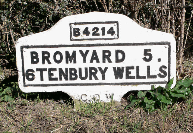
Image: © J Higgins Taken: 1 Apr 2007
Metal plates attached to concrete post by the B4214, in parish of STOKE BLISS (MALVERN HILLS District), opposite lane to Grithill Farm, 30 yards from county boundary, in hedge, on East side of road. Bradley post, erected by the County Council in the 20th century. Inscription reads:- B4214 BROMYARD 5. 6 TENBURY WELLS C.C.W. Milestone Society National ID: WO_TBBY06.
Images are licensed for reuse under creativecommons.org/licenses/by-sa/2.0
Image Location


Leaflet Map data © OpenStreetMap
Latitude
52.251209
Longitude
-2.522811