Old Bridge Marker on the B4214 near Grithill Farm
Introduction
The photograph on this page of Old Bridge Marker on the B4214 near Grithill Farm by Roadside Relics as part of the Geograph project.
The Geograph project started in 2005 with the aim of publishing, organising and preserving representative images for every square kilometre of Great Britain, Ireland and the Isle of Man.

There are currently over 7.5m images from over 14,400 individuals and you can help contribute to the project by visiting https://www.geograph.org.uk
Old Bridge Marker on the B4214 near Grithill Farm
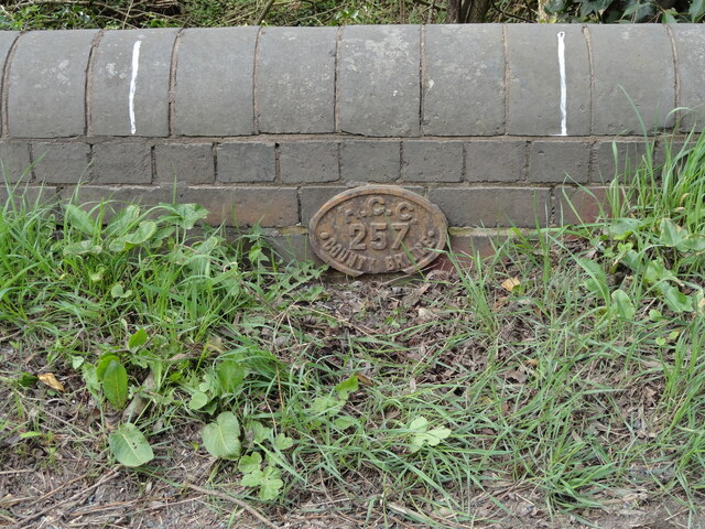
Image: © Roadside Relics Taken: 20 Apr 2022
Bridge Marker fixed to the west parapet of an unnamed bridge near Grithill Farm on the B4214 over Netherwood Brook in Collington parish. The bridge links Collington, Herefordshire and Stoke Bliss, Worcestershire. There is no corresponding marker on the Worcestershire side. BS (boundary stone) is shown on OS maps, which might have prevented arguments between County Council teams, but it could not be found. Milestone Society National ID: HF_COLLIN01br
Images are licensed for reuse under creativecommons.org/licenses/by-sa/2.0
Image Location


Leaflet Map data © OpenStreetMap
Latitude
52.250914
Longitude
-2.522617