
IMAGES TAKEN NEAR TO
Mallow Close, MALVERN, WR14 3SS
Introduction
This page details the photographs taken nearby to Mallow Close, WR14 3SS by members of the Geograph project.
The Geograph project started in 2005 with the aim of publishing, organising and preserving representative images for every square kilometre of Great Britain, Ireland and the Isle of Man.

There are currently over 7.5m images from over14,400 individuals and you can help contribute to the project by visiting https://www.geograph.org.uk
Image Map
Images are licensed for reuse under creativecommons.org/licenses/by-sa/2.0
Notes
- Clicking on the map will re-center to the selected point.
- The higher the marker number, the further away the image location is from the centre of the postcode.
Image Listing (55 Images Found)
Images are licensed for reuse under creativecommons.org/licenses/by-sa/2.0
Image
Details
Distance
1
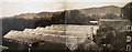
Tomato houses at The Elms, Barnard's Green
Built by the photographer's brother (contributor's grandfather) following his discharge from the Royal Navy and photographed from an attic window.
Some of the area covered by the glasshouses is now part of the relatively new development of Mallow Close.
Malvern Hills in the background.
For a view of the associated house taken around the same date see Image
Image: © R E Joan Batterham
Taken: Unknown
0.00 miles
2
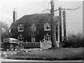
The Elms, Guarlford Road, Barnard's Green 1927
The house had no close neighbours to the west at this time.
The contributor's grandparents are seen just inside the gate.
See also Image
For a 2015 view of the same house see http://www.geograph.org.uk/photo/4720630
Image: © R E Joan Batterham
Taken: Unknown
0.03 miles
3
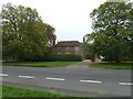
The Elms, Guarlford Road, Barnard's Green
Compare with Image
Image: © Penny Mayes
Taken: 18 Oct 2015
0.03 miles
4
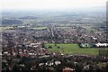
The Guarlford straight
The name given to the road from Guarlford towards Great Malvern.
It runs through a strip of common land and is lined with an avenue of trees providing an excellent approach to Malvern with the Worcestershire Beacon above and beyond the town.
Taken from the Malvern Hills on a spur between St Ann's Well and Rushy Valley.
On the right can be seen some of the buildings of Malvern's Science Park near QinetiQ.
The playing fields are used by one of the several boarding schools located here.
Image: © Bob Embleton
Taken: 30 Jan 2011
0.04 miles
5
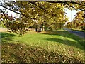
Autumn colour on the Guarlford straight
Every autumn the trees on the Guarlford straight into Malvern are a blaze of colour.
Image: © Philip Halling
Taken: 26 Oct 2016
0.05 miles
6
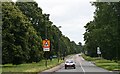
The Guarlford Straight, Barnard's Green
A lovely avenue with common land on either side.
Image: © Bob Embleton
Taken: 5 Jul 2007
0.05 miles
7
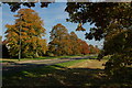
Trees on the Guarlford Road
Each autumn the trees on the Guarlford Road display wonderful colours.
Image: © Philip Halling
Taken: 12 Oct 2008
0.06 miles
8
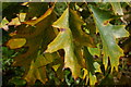
Autumn leaves
Autumn leaves on a tree on the Guarlford Road, Malvern.
Image: © Philip Halling
Taken: 12 Oct 2008
0.06 miles
9
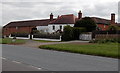
Northern side of Mill Farm and Millers Croft, Malvern
Former farm and buildings on the south side of Guarlford Road, converted to residential use.
Image: © Jaggery
Taken: 5 May 2013
0.06 miles
10
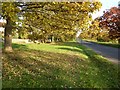
Autumn trees on the Guarlford Road
Every autumn the trees on the Guarlford Road into Malvern are a blaze of colour.
Image: © Philip Halling
Taken: 26 Oct 2016
0.07 miles