The Guarlford straight
Introduction
The photograph on this page of The Guarlford straight by Bob Embleton as part of the Geograph project.
The Geograph project started in 2005 with the aim of publishing, organising and preserving representative images for every square kilometre of Great Britain, Ireland and the Isle of Man.

There are currently over 7.5m images from over 14,400 individuals and you can help contribute to the project by visiting https://www.geograph.org.uk
The Guarlford straight
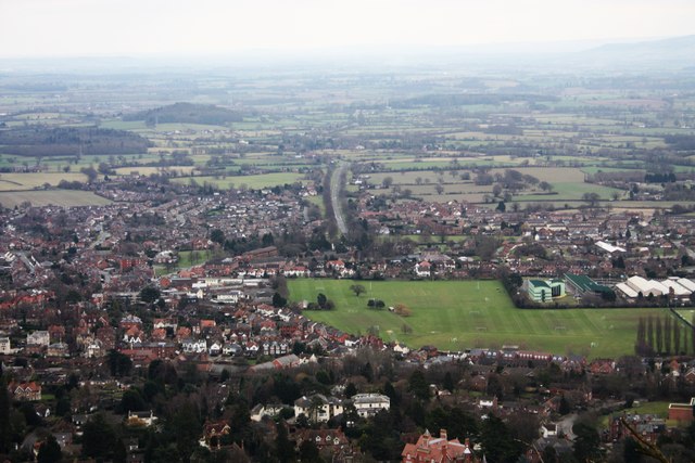
Image: © Bob Embleton Taken: 30 Jan 2011
The name given to the road from Guarlford towards Great Malvern. It runs through a strip of common land and is lined with an avenue of trees providing an excellent approach to Malvern with the Worcestershire Beacon above and beyond the town. Taken from the Malvern Hills on a spur between St Ann's Well and Rushy Valley. On the right can be seen some of the buildings of Malvern's Science Park near QinetiQ. The playing fields are used by one of the several boarding schools located here.
Images are licensed for reuse under creativecommons.org/licenses/by-sa/2.0
Image Location
Latitude
52.106371
Longitude
-2.298832