IMAGES TAKEN NEAR TO
Aston Road, BROADWAY, WR12 7NT
Introduction
This page details the photographs taken nearby to Aston Road, WR12 7NT by members of the Geograph project.
The Geograph project started in 2005 with the aim of publishing, organising and preserving representative images for every square kilometre of Great Britain, Ireland and the Isle of Man.

There are currently over 7.5m images from over14,400 individuals and you can help contribute to the project by visiting https://www.geograph.org.uk
Image Map (Loading...)


Getting Data...Please wait
Leaflet Map data © OpenStreetMap
Images are licensed for reuse under creativecommons.org/licenses/by-sa/2.0
Notes
- Clicking on the map will re-center to the selected point.
- The higher the marker number, the further away the image location is from the centre of the postcode.
Image Listing (28 Images Found)
Images are licensed for reuse under creativecommons.org/licenses/by-sa/2.0
Image
Details
Distance
1
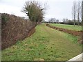
Footpath to Broadway
The path passes along the edge of this long field. The ditch has obviously just been re-dug.
Image: © Michael Dibb
Taken: 10 Feb 2010
0.12 miles
4
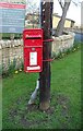
Elizabeth II postbox, Childswickham
Postbox No. WR12 207.
Image: © JThomas
Taken: 15 Apr 2023
0.17 miles
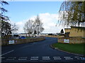
6
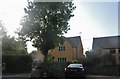
Houses on Pennylands Bank, Childswickham
Image: © David Howard
Taken: 10 Aug 2019
0.19 miles
7
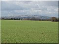
Worcestershire farmland
Seen from near the sewage works. The sunlit slopes of Bredon Hill [SO9540'>Image are in the background.
Image: © Michael Dibb
Taken: 10 Feb 2010
0.21 miles
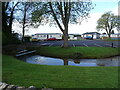
8
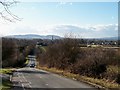
Pennylands Bank
From the junction of Pennylands Bank with Evesham Road is this view over Childswickham. The spire of St Mary's church is prominent. In the distance are Dumbleton Hill Image (immediately behind the church spire) and Alderton Hill Image (to the left) - two Cotswold outliers.
Image: © Michael Dibb
Taken: 10 Feb 2010
0.22 miles
9
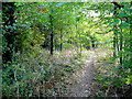
Footpath through the trees
This path skirts south around St. Mary's churchyard.
Image: © Jonathan Billinger
Taken: 24 Sep 2009
0.22 miles
10
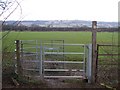
Farmland and scarp slope
At the end of the long field traversed by the footpath, is a new kissing gate. Beyond is a planted field. The view extends as far as the Cotswolds scarp slope. Broadway Tower Image is just discernible on the skyline in the centre of the image.
Image: © Michael Dibb
Taken: 10 Feb 2010
0.23 miles