Pennylands Bank
Introduction
The photograph on this page of Pennylands Bank by Michael Dibb as part of the Geograph project.
The Geograph project started in 2005 with the aim of publishing, organising and preserving representative images for every square kilometre of Great Britain, Ireland and the Isle of Man.

There are currently over 7.5m images from over 14,400 individuals and you can help contribute to the project by visiting https://www.geograph.org.uk
Pennylands Bank
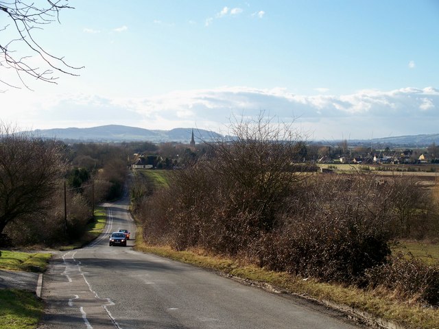
Image: © Michael Dibb Taken: 10 Feb 2010
From the junction of Pennylands Bank with Evesham Road is this view over Childswickham. The spire of St Mary's church is prominent. In the distance are Dumbleton Hill Image (immediately behind the church spire) and Alderton Hill Image (to the left) - two Cotswold outliers.
Images are licensed for reuse under creativecommons.org/licenses/by-sa/2.0
Image Location
Latitude
52.045647
Longitude
-1.88389