Farmland and scarp slope
Introduction
The photograph on this page of Farmland and scarp slope by Michael Dibb as part of the Geograph project.
The Geograph project started in 2005 with the aim of publishing, organising and preserving representative images for every square kilometre of Great Britain, Ireland and the Isle of Man.

There are currently over 7.5m images from over 14,400 individuals and you can help contribute to the project by visiting https://www.geograph.org.uk
Farmland and scarp slope
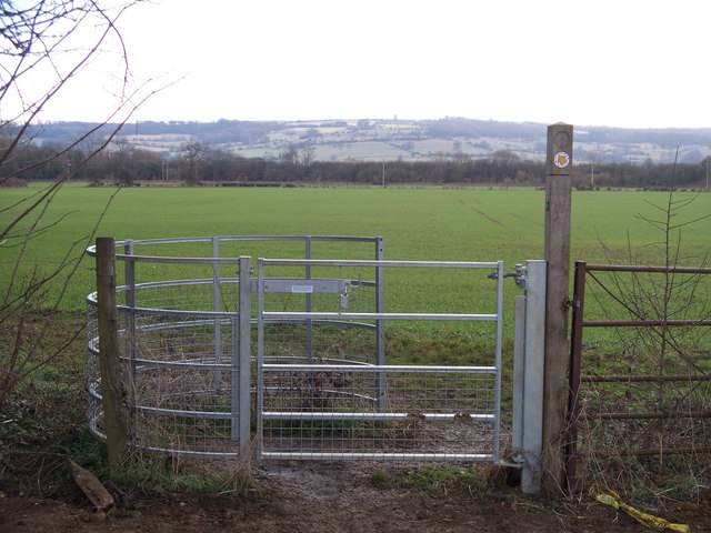
Image: © Michael Dibb Taken: 10 Feb 2010
At the end of the long field traversed by the footpath, is a new kissing gate. Beyond is a planted field. The view extends as far as the Cotswolds scarp slope. Broadway Tower Image is just discernible on the skyline in the centre of the image.
Images are licensed for reuse under creativecommons.org/licenses/by-sa/2.0
Image Location
Latitude
52.040431
Longitude
-1.882008