
IMAGES TAKEN NEAR TO
Upper South Street, DEWSBURY, WF13 2EQ
Introduction
This page details the photographs taken nearby to Upper South Street, WF13 2EQ by members of the Geograph project.
The Geograph project started in 2005 with the aim of publishing, organising and preserving representative images for every square kilometre of Great Britain, Ireland and the Isle of Man.

There are currently over 7.5m images from over14,400 individuals and you can help contribute to the project by visiting https://www.geograph.org.uk
Image Map
Images are licensed for reuse under creativecommons.org/licenses/by-sa/2.0
Notes
- Clicking on the map will re-center to the selected point.
- The higher the marker number, the further away the image location is from the centre of the postcode.
Image Listing (300 Images Found)
Images are licensed for reuse under creativecommons.org/licenses/by-sa/2.0
Image
Details
Distance
1
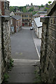
Lower Peel Street
Looking towards Bradford Road from the footpath from Crackenedge Lane
Image: © Alan Murray-Rust
Taken: 20 May 2007
0.01 miles
2
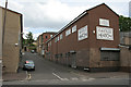
Lower Peel Street
The opposite direction to Image The modern factory buildings follow the same pattern of development as older premises with narrow frontages, but the use of brick rather than stone makes them look out of place.
Image: © Alan Murray-Rust
Taken: 20 May 2007
0.02 miles
4
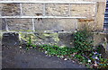
Benchmark on building at east end of Lower Peel Street
Ordnance Survey cut mark benchmark
Image: © Luke Shaw
Taken: 30 Aug 2018
0.02 miles
5
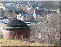
Air shaft, Upper Peel Street, Dewsbury
This is on the former Dewsbury and Batley Branch Line, part of the Great Northern Railway in 1907. It went in a tunnel through a spur of hillside, avoiding the floor of the valley. While it is in the tunnel, the Dewsbury to Leeds line (LNER in 1907), the present railway, crosses over it.
Image: © Humphrey Bolton
Taken: 4 Mar 2010
0.03 miles
6
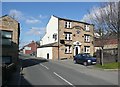
The Crackenedge Hotel, Crackenedge Lane, Dewsbury
Although not shown on Jeffreys's map of 1775, I feel sure that Crackenedge Lane must have existed as the way from Dewsbury to Leeds in the late 18C or early 19C, when this public house was probably built.
Image: © Humphrey Bolton
Taken: 4 Mar 2010
0.03 miles
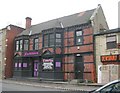
8
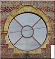
Dewsbury - Glory Band Tabernacle
Window detail. For a wider view of the building, please see Image
Image: © Dave Bevis
Taken: 5 May 2014
0.03 miles
9
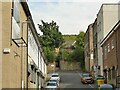
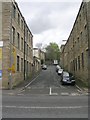
Lower Peel Street, Dewsbury
At the top of the street is a pedestrian underpass beneath the present Leeds-Huddersfield railway line leading to Upper Peel Street; beyond the railway can be glimpsed a domed shaft which was an air shaft on a tunnel taking the Great Northern's Dewsbury and Batley line beneath the main line Image
Image: © Stephen Craven
Taken: 4 Sep 2022
0.03 miles
10
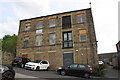
Building housing Saville Heaton, Lower Peel Street
There is an OS benchmark Image on the front of building left of the roller door
Image: © Luke Shaw
Taken: 30 Aug 2018
0.03 miles