IMAGES TAKEN NEAR TO
The Pines, DEWSBURY, WF12 8RN
Introduction
This page details the photographs taken nearby to The Pines, WF12 8RN by members of the Geograph project.
The Geograph project started in 2005 with the aim of publishing, organising and preserving representative images for every square kilometre of Great Britain, Ireland and the Isle of Man.

There are currently over 7.5m images from over14,400 individuals and you can help contribute to the project by visiting https://www.geograph.org.uk
Image Map
Images are licensed for reuse under creativecommons.org/licenses/by-sa/2.0
Notes
- Clicking on the map will re-center to the selected point.
- The higher the marker number, the further away the image location is from the centre of the postcode.
Image Listing (58 Images Found)
Images are licensed for reuse under creativecommons.org/licenses/by-sa/2.0
Image
Details
Distance
1
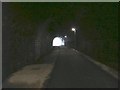
Inside the Earlsheaton railway tunnel
The street lighting in the tunnel provides adequate illumination from arrays of what I think must be LEDs.
Image: © Humphrey Bolton
Taken: 10 Jan 2013
0.02 miles
4
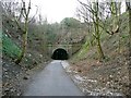
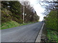
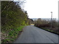
Approach to the eastern portal of the Earlsheaton tunnel
When I took Image I was not at all confident that the tunnel could be re-opened as a cycling route, but here it is - part of a route that might eventually reach Wakefield.
Image: © Humphrey Bolton
Taken: 10 Jan 2013
0.05 miles
5
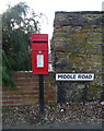
Elizabeth II postbox on Middle Road, Earlsheaton
Postbox No. WF12 1.
See Image] for context.
Image: © JThomas
Taken: 6 Mar 2020
0.05 miles
6
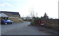
Middle Road, Earlsheaton
Junction with Headland Lane.
Showing position of Postbox No. WF12 1
See Image] for postbox.
Image: © JThomas
Taken: 6 Mar 2020
0.06 miles
7
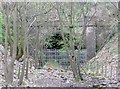
Tunnel portal, Earlsheaton
This is the eastern portal of the disused railway tunnel shown in Image It is in a deep wooded cutting.
Image: © Humphrey Bolton
Taken: 9 Apr 2009
0.07 miles
8
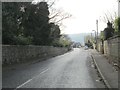
Headland Road - viewed from Laithes Croft
Image: © Betty Longbottom
Taken: 26 Nov 2013
0.07 miles
9
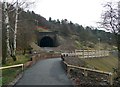
Approach to the Earlsheaton Tunnel
This is the latest section of the Calder Valley Greenway, which leaves Dewsbury along Sands Lane and then climbs up to this newly opened tunnel on its way to Pildacre lane and Ossett.
Image: © Humphrey Bolton
Taken: 10 Jan 2013
0.07 miles