Approach to the eastern portal of the Earlsheaton tunnel
Introduction
The photograph on this page of Approach to the eastern portal of the Earlsheaton tunnel by Humphrey Bolton as part of the Geograph project.
The Geograph project started in 2005 with the aim of publishing, organising and preserving representative images for every square kilometre of Great Britain, Ireland and the Isle of Man.

There are currently over 7.5m images from over 14,400 individuals and you can help contribute to the project by visiting https://www.geograph.org.uk
Approach to the eastern portal of the Earlsheaton tunnel
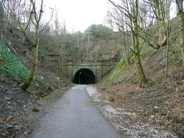
Image: © Humphrey Bolton Taken: 10 Jan 2013
When I took Image I was not at all confident that the tunnel could be re-opened as a cycling route, but here it is - part of a route that might eventually reach Wakefield.
Images are licensed for reuse under creativecommons.org/licenses/by-sa/2.0
Image Location
Latitude
53.683579
Longitude
-1.614936