
IMAGES TAKEN NEAR TO
Ouzelwell Lane, DEWSBURY, WF12 0RY
Introduction
This page details the photographs taken nearby to Ouzelwell Lane, WF12 0RY by members of the Geograph project.
The Geograph project started in 2005 with the aim of publishing, organising and preserving representative images for every square kilometre of Great Britain, Ireland and the Isle of Man.

There are currently over 7.5m images from over14,400 individuals and you can help contribute to the project by visiting https://www.geograph.org.uk
Image Map
Images are licensed for reuse under creativecommons.org/licenses/by-sa/2.0
Notes
- Clicking on the map will re-center to the selected point.
- The higher the marker number, the further away the image location is from the centre of the postcode.
Image Listing (13 Images Found)
Images are licensed for reuse under creativecommons.org/licenses/by-sa/2.0
Image
Details
Distance
1

Ouzelwell Lane
A concrete farm access track. View downhill towards Thornhill.
Image: © Stephen Craven
Taken: 14 Jan 2017
0.13 miles
2

Ordnance Survey Cut Mark
This mark can be found on a stone post in Ouzelwell Lane.
For more details see : http://www.bench-marks.org.uk/bm41885
Image: © Peter Wood
Taken: 11 Mar 2012
0.14 miles
3
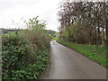
Continuation of Ouzelwell Lane - off Lees Hall Road
Image: © Betty Longbottom
Taken: 11 Nov 2014
0.14 miles
4
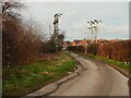
Electricity cables across Ouzelwell Lane, Thornhill Lees
This is where an underground cable changes to being overhead.
Image: © Humphrey Bolton
Taken: 16 Feb 2023
0.14 miles
5

Small building near Crow Royd
The purpose of the building was not clear, probably some agricultural storage.
Image: © Stephen Craven
Taken: 14 Jan 2017
0.18 miles
6
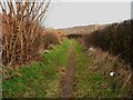
Footpath around the edge of the Ouzewell Lane housing estate
This path goes to King Edward Street. It seems to have been missed when the rights-of-way were established.
Image: © Humphrey Bolton
Taken: 16 Feb 2023
0.18 miles
7

Houses on Ouzelwell Lane
This view is of the rear of the properties.
Image: © Stephen Craven
Taken: 14 Jan 2017
0.19 miles
8
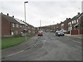
Ouzelwell Crescent - Ouzelwell Lane
Image: © Betty Longbottom
Taken: 11 Nov 2014
0.19 miles
9

Fallow field with trees, Thornhill Lees
Image: © Humphrey Bolton
Taken: 16 Feb 2023
0.20 miles
10

Track to Ravensthorpe Road
A farm access track, with bridleway status.
Image: © Stephen Craven
Taken: 14 Jan 2017
0.24 miles