IMAGES TAKEN NEAR TO
The Cross, DEWSBURY, WF12 0RD
Introduction
This page details the photographs taken nearby to The Cross, WF12 0RD by members of the Geograph project.
The Geograph project started in 2005 with the aim of publishing, organising and preserving representative images for every square kilometre of Great Britain, Ireland and the Isle of Man.

There are currently over 7.5m images from over14,400 individuals and you can help contribute to the project by visiting https://www.geograph.org.uk
Image Map
Images are licensed for reuse under creativecommons.org/licenses/by-sa/2.0
Notes
- Clicking on the map will re-center to the selected point.
- The higher the marker number, the further away the image location is from the centre of the postcode.
Image Listing (52 Images Found)
Images are licensed for reuse under creativecommons.org/licenses/by-sa/2.0
Image
Details
Distance

3
Old Central Cross by The Town, Thornhill, Dewsbury
The Market Cross, stump of shaft by the UC road, in parish of Dewsbury (Kirklees District), Thornhill, The Town, Overthorpe; opposite junction with Combs Road.
Grade II Listed. List Entry Number: 1313647
https://historicengland.org.uk/listing/the-list/list-entry/1313647
Surveyed
Milestone Society National ID: YWKL_DEW02
Image: © Milestone Society
Taken: Unknown
0.03 miles
4

The Cross, Thornhill
According to Historic England who list this grade II (list entry 1313647), the nearer stone is the base of a Market Cross of the C17 or earlier. In 1865 the adjacent drinking fountain was added, also covered by the listing. The brass plate is to 'Ridley Rewcastle Clerk of Works on the Savile York Estates Died April 21st 1865'.
Image: © Stephen Craven
Taken: 24 Jul 2026
0.03 miles
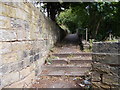
6
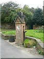
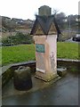
Drinking Fountain, The Town, Thornhill
An elaborately carved top, looking like a square house with gables and a large chimney in the middle. The fountain no longer works.
Image: © Humphrey Bolton
Taken: 18 Sep 2008
0.04 miles
7
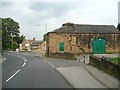
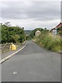
The lower end of Edge Top Road, Thornhill
The road junction is with The Town, and Overthorpe Road continues round to the left. The building on the right looks like a former barn.
Image: © Humphrey Bolton
Taken: 18 Sep 2008
0.04 miles
8
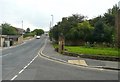
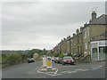
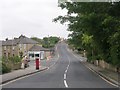
The Town, Thornhill
The Town is the name of the main street of Thornhill village. For a closer view of the drinking fountain see Image
Image: © Humphrey Bolton
Taken: 18 Sep 2008
0.04 miles