IMAGES TAKEN NEAR TO
Wrights Lane, KNOTTINGLEY, WF11 0BT
Introduction
This page details the photographs taken nearby to Wrights Lane, WF11 0BT by members of the Geograph project.
The Geograph project started in 2005 with the aim of publishing, organising and preserving representative images for every square kilometre of Great Britain, Ireland and the Isle of Man.

There are currently over 7.5m images from over14,400 individuals and you can help contribute to the project by visiting https://www.geograph.org.uk
Image Map
Images are licensed for reuse under creativecommons.org/licenses/by-sa/2.0
Notes
- Clicking on the map will re-center to the selected point.
- The higher the marker number, the further away the image location is from the centre of the postcode.
Image Listing (23 Images Found)
Images are licensed for reuse under creativecommons.org/licenses/by-sa/2.0
Image
Details
Distance
1
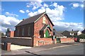
Cridling Stubbs Community Centre
Formerly a Chapel, now a community centre.
Image: © Bill Henderson
Taken: 24 Aug 2006
0.02 miles
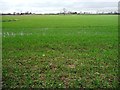
2
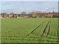
Cridling Stubbs
Looking across to the village from Northfield Lane with a crop of winter cereal in the foreground.
Image: © Alan Murray-Rust
Taken: 24 Dec 2013
0.03 miles
4
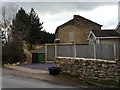
Shadow of a former building, Cridling Stubbs
On the northern wall of a house in Wrights Lane.
Image: © Christine Johnstone
Taken: 19 Feb 2014
0.03 miles
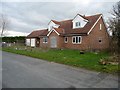
5
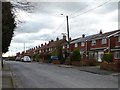
West side of Wrights Lane, Cridling Stubbs
Newer detached houses, older semi-detached ones.
Image: © Christine Johnstone
Taken: 19 Feb 2014
0.04 miles
6
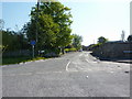
Cridling Stubbs
At the junction of Wrights Lane and Cobcroft Lane.
Image: © Christine Johnstone
Taken: 19 Feb 2014
0.04 miles

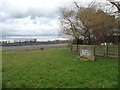
8
Waterlogged field, north of Cobcroft Lane
The public footpath to Cridling Park is mapped across this field.
Image: © Christine Johnstone
Taken: 19 Feb 2014
0.08 miles
9
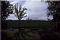
Garden and field at Cridling Stubbs
Possibly one of England's strangest place names, the village expanded into the fields when a row of council houses were built in the 1950's
Image: © James Gibb
Taken: Unknown
0.08 miles
10
Unfinished new house, Cridling Stubbs
At the eastern end of the by-passed and truncated section of Cobcroft Lane.
Image: © Christine Johnstone
Taken: 19 Feb 2014
0.09 miles