IMAGES TAKEN NEAR TO
Barley Road, WARRINGTON, WA4 2NF
Introduction
This page details the photographs taken nearby to Barley Road, WA4 2NF by members of the Geograph project.
The Geograph project started in 2005 with the aim of publishing, organising and preserving representative images for every square kilometre of Great Britain, Ireland and the Isle of Man.

There are currently over 7.5m images from over14,400 individuals and you can help contribute to the project by visiting https://www.geograph.org.uk
Image Map
Images are licensed for reuse under creativecommons.org/licenses/by-sa/2.0
Notes
- Clicking on the map will re-center to the selected point.
- The higher the marker number, the further away the image location is from the centre of the postcode.
Image Listing (15 Images Found)
Images are licensed for reuse under creativecommons.org/licenses/by-sa/2.0
Image
Details
Distance
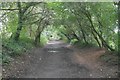
2
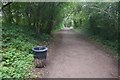
Trans-Pennine Trail at Lymm, Cheshire
Covering 215 miles, linking the North and Irish seas, the Trans Pennine Trail crosses Northern England from Southport in the west to Hornsea in the east running through the cities of Liverpool, Manchester, Leeds, Sheffield and Hull. There is also a 15 mile spur between Selby and York along this line.
A 70 mile north to south trail runs from Leeds through Wakefield, Barnsley, Sheffield and the Rother Valley Country Park before terminating in Chesterfield. The route also has several deviations and loops south of the west/east trail, including one to Rotherham. This means in total there is 350 miles of Trans Pennine Trail to discover
Image: © Matt Harrop
Taken: 9 Apr 2015
0.07 miles
5
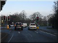
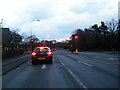
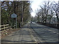
Stockport Road (A56), looking west at Stanton Road
Image: © Peter Whatley
Taken: 17 Jan 2012
0.16 miles
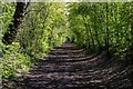
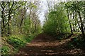
7
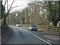
Trans Pennine Trail, Grappenhall
The closure was probably precipitated by the need to renovate the Latchford Viaduct. At that time one of the Stupid's big ideas was an ideological loathing of railways. Even the Forth Bridge (same engineers, Arrol) was considered for closure.
Image: © Richard Webb
Taken: 11 Aug 2019
0.17 miles
8
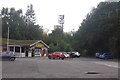
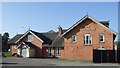
British Legion
Grappenhall and Thelwall Royal British Legion - games hall and car park.
Image: © Richard Webb
Taken: 11 Aug 2019
0.18 miles