IMAGES TAKEN NEAR TO
Green Lane, LONDON, W7 2PT
Introduction
This page details the photographs taken nearby to Green Lane, W7 2PT by members of the Geograph project.
The Geograph project started in 2005 with the aim of publishing, organising and preserving representative images for every square kilometre of Great Britain, Ireland and the Isle of Man.

There are currently over 7.5m images from over14,400 individuals and you can help contribute to the project by visiting https://www.geograph.org.uk
Image Map
Images are licensed for reuse under creativecommons.org/licenses/by-sa/2.0
Notes
- Clicking on the map will re-center to the selected point.
- The higher the marker number, the further away the image location is from the centre of the postcode.
Image Listing (274 Images Found)
Images are licensed for reuse under creativecommons.org/licenses/by-sa/2.0
Image
Details
Distance
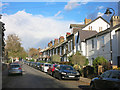
1
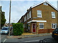
Looking north across the west end of Churchfield Road
Image: © Shazz
Taken: 12 Sep 2013
0.03 miles
2
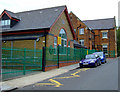
St Mark's School
On Green Lane at Lower Boston Road.
Image: © Thomas Nugent
Taken: 29 Aug 2011
0.05 miles
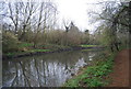
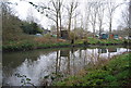
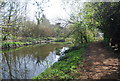
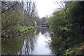
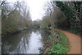
5
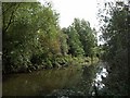
River Brent
Looking downstream; the river is about to meet the Grand Union Canal. Seen from Fitzherbert Walk.
Image: © Derek Harper
Taken: 20 Sep 2010
0.07 miles