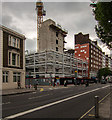
IMAGES TAKEN NEAR TO
Hammersmith Road, LONDON, W6 8BT

Introduction

This page details the photographs taken nearby to Hammersmith Road, W6 8BT by members of the Geograph project.

The Geograph project started in 2005 with the aim of publishing, organising and preserving representative images for every square kilometre of Great Britain, Ireland and the Isle of Man.

There are currently over 7.5m images from over14,400 individuals and you can help contribute to the project by visiting https://www.geograph.org.uk

Image Map


Images are licensed for reuse under creativecommons.org/licenses/by-sa/2.0
Notes
  • Clicking on the map will re-center to the selected point.
  • The higher the marker number, the further away the image location is from the centre of the postcode.

Image Listing (295 Images Found)

Images are licensed for reuse under creativecommons.org/licenses/by-sa/2.0
  • ...
Image
Details
Distance
1
Shortlands
Hammersmith office block
Image: © Richard Croft Taken: 8 Oct 2013
0.02 miles
2
Novotel London West
Image: © Flying Stag Taken: 21 Aug 2014
0.02 miles
3
Kings House
The Kings House development on Hammersmith Road.
Image: © Peter McDermott Taken: 18 May 2016
0.03 miles
4
Main entrance to Fulham's former WW1 drill hall
190-2 Hammersmith Road. The site is now used by the Army Reserve, the Army Cadet Force and the Air Training Corps.
Image: © Christine Johnstone Taken: 22 Apr 2015
0.03 miles
5
London : Hammersmith - Shortlands
Shortlands is a road just off of Hammersmith Road which leads to Talgarth Road.
Image: © Lewis Clarke Taken: 13 May 2011
0.04 miles
6
Roof garden, 245 Hammersmith Road
This terrace is on the 10th floor. Photo taken during London Open Gardens weekend.
Image: © David Hawgood Taken: 11 Jun 2023
0.04 miles
7
Vehicle entrance to Fulham's former WW1 Drill Hall
On the west side of Rowan Road. The drill hall is the whitewashed building behind the gate. The site is now used by the Army Reserve, the Army Cadet Force and the Air Training Corps.
Image: © Christine Johnstone Taken: 22 Apr 2015
0.04 miles
8
Hammersmith Road
Looking east from Hammersmith Broadway
Image: © Alexander P Kapp Taken: 8 Mar 2009
0.04 miles
9
Chalkhill Road, W6
This 'U' shaped cul-de-sac is about 85% under shelter, beyond the white wall on the left is a ramp leading to an underground car-park belonging to the Novotel.
Image: © Phillip Perry Taken: 17 Nov 2008
0.05 miles
10
Chalkhill Road II, W6
A service road that runs underneath the Novotel and the neighbouring Commonwealth House office block.
Image: © Phillip Perry Taken: 17 Nov 2008
0.05 miles
  • ...