1
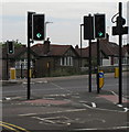
Hanger Lane, W5
Near the Fox and Goose pub / hotel, and showing (in the distance) Middlesex House. The yellow and red sign for the McDonald's, with its distinctive shape and colouring, is prominent out of all proportion to its size.
Image: © Danny P Robinson
Taken: 11 Mar 2007
0.01 miles
2
Fox and Goose, Hanger Lane, Ealing.
Fuller's public house and hotel near Hanger Lane Gyratory.
Image: © Baggy Suggs
Taken: Unknown
0.01 miles
3
The Fox and Goose, Hanger Lane
A pub with hotel rooms attached.
Image: © Philip Cornwall
Taken: 4 Oct 2020
0.04 miles
4
Hanger Hill [1]
The Fox and Goose, Hanger Lane, was built in the 19th century and has recently been modernized and a large accommodation block constructed.
Hanger Hill is an area of the London borough of Ealing. It is famous, or perhaps infamous, for the Hanger Lane gyratory, a complex and busy road junction where the North Circular Road (A406) crosses Western Avenue (A40). The gyratory incorporates Hanger Lane Station on the London Underground.
Image: © Michael Dibb
Taken: 5 Feb 2023
0.05 miles
5
Traffic light green for cyclists only across Hanger Lane
The cycle path comes up from Priory Gardens and across Hanger Lane to West Gate. The lights are green long enough for cyclists, but not for some pedestrians.
Image: © David Hawgood
Taken: 21 Aug 2011
0.05 miles
6
"Cycle Crossing Only" across Hanger Lane North
This is across the busy A4005 dual carriageway to Alperton and Wembley. It has been provided so that cyclists do not have to go via the subways to the tube station, but the green phase is too short for some pedestrians. It crosses from West Gate to Priory Gardens. In the photo the traffic light across the road is green for cyclists.
Image: © David Hawgood
Taken: 21 Aug 2011
0.05 miles
7
Traffic lights amber at cycle crossing on Hanger Lane
The crossing is described in
Image
Image: © David Hawgood
Taken: 21 Aug 2011
0.05 miles
8
West Gate
Image: © N Chadwick
Taken: 11 Sep 2021
0.05 miles
9
Cycle track from Priory Gardens to cross Hanger Lane
Priory Gardens has a subway under the North Circular to Park Royal, one to the centre of the Hanger Lane Gyratory, and this new cycle track to a "cyclists only" crossing on Hanger Lane.
Image: © David Hawgood
Taken: 21 Aug 2011
0.06 miles
10
Hanger Hill [2]
Seen from Hanger Lane, West Gate provides access to a complex of offices and warehouses.
Hanger Hill is an area of the London Borough of Ealing. It is famous, or perhaps infamous, for the Hanger Lane gyratory, a complex and busy road junction where the North Circular Road (A406) crosses Western Avenue (A40). The gyratory incorporates Hanger Lane Station on the London Underground.
Image: © Michael Dibb
Taken: 5 Feb 2023
0.06 miles


![Hanger Hill [1]](https://s3.geograph.org.uk/geophotos/07/41/06/7410635_f837c120_120x120.jpg)


![Hanger Hill [2]](https://s1.geograph.org.uk/geophotos/07/41/06/7410637_7bdc3d10_120x120.jpg)