1
Ayr Court flats
Image: © David Hawgood
Taken: 30 Apr 2010
0.01 miles
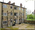
2
Back of a mock-Tudor block of flats, Monks Drive
The front and sides of the 1930s flats are half-timbered. The back is left plain. These are flats of type E in the conservation area appraisal http://www.ealing.gov.uk/ealing3/export/sites/ealingweb/services/environment/planning/planning_services/conservation/_docs/_appraisals/Hanger_Hill_Garden_Estate_CA_Appraisal.pdf .
Image: © David Hawgood
Taken: 30 Apr 2010
0.01 miles
3
Ayr Court, Hanger Hill
Part of the Hanger Hill Garden Estate. Developed between 1928 and 1932 on land that had been an airfield in the first world war.
This quote is from the residents association website. "The Hanger Hill Garden Estate is one of the finest examples of what is popularly known as Mock Tudor architecture. But don't mock it too hard. The style is no longer unfashionable: the Estate's quiet surroundings, disturbed only by birdsong and the snuffling of hedgehogs in the privet on summer evenings, are within easy reach of both Heathrow and central London. The houses and flats on the Estate command high prices and residents will bear witness to the reality of what the writer Nicklaus Pevsner has described as "the beau ideal of romantic ideal Metroland".
A full history plus slideshow is on http://www.hhgera.com/page4.htm
Anyone like me with a soft spot for suburbs has got to be impressed by this place.
Image: © Des Blenkinsopp
Taken: 14 Jun 2013
0.02 miles
4
Mock-Tudor flats round a lawn, Monks Drive
Three blocks of flats (type E in the conservation area appraisal http://www.ealing.gov.uk/ealing3/export/sites/ealingweb/services/environment/planning/planning_services/conservation/_docs/_appraisals/Hanger_Hill_Garden_Estate_CA_Appraisal.pdf ) are set back from the road facing onto a lawn.
Image: © David Hawgood
Taken: 30 Apr 2010
0.02 miles
5
Block of flats with cherry blossom, Monks Drive
The cherry blossom is falling, as shown in
Image The block of flats is type E in the conservation area appraisal.
Image: © David Hawgood
Taken: 30 Apr 2010
0.03 miles
6
Flats by end of Mason's Green Lane
Image: © David Hawgood
Taken: 30 Apr 2010
0.03 miles
7
School street traffic restriction, Hanger Vale, Ealing
The sign prohibits motor traffic on weekdays, at the times when pupils arrive or leave, 8.15 to 9.15 am and 3.00 to 4.00 pm, for the street Hanger Vale outside Holy Family Catholic primary school. The restriction came into force in September 2020.
Image: © David Hawgood
Taken: 21 Feb 2021
0.03 miles
8
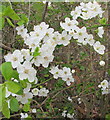
Cherry plum blossom in hedge, West Acton
Low hedge in Monk's Drive, Hanger Hill Garden Estate
Image: © David Hawgood
Taken: 21 Mar 2021
0.04 miles
9
Benchmark on Bridge D24,Hanger View Way
Ordnance Survey cut mark benchmark described on the Bench Mark Database at http://www.bench-marks.org.uk/bm74530
Image: © Roger Templeman
Taken: 1 Apr 2016
0.04 miles
10
North parapet of Bridge D24, Hanger Vale Lane
There is an OS benchmark
Image at the right hand end of the parapet at the junction with the metal fence
Image: © Roger Templeman
Taken: 1 Apr 2016
0.04 miles


