IMAGES TAKEN NEAR TO
Great Western Road, LONDON, W2 5UF
Introduction
This page details the photographs taken nearby to Great Western Road, W2 5UF by members of the Geograph project.
The Geograph project started in 2005 with the aim of publishing, organising and preserving representative images for every square kilometre of Great Britain, Ireland and the Isle of Man.

There are currently over 7.5m images from over14,400 individuals and you can help contribute to the project by visiting https://www.geograph.org.uk
Image Map
Images are licensed for reuse under creativecommons.org/licenses/by-sa/2.0
Notes
- Clicking on the map will re-center to the selected point.
- The higher the marker number, the further away the image location is from the centre of the postcode.
Image Listing (333 Images Found)
Images are licensed for reuse under creativecommons.org/licenses/by-sa/2.0
Image
Details
Distance

3
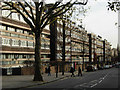
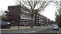
Great Western Road, Westbourne Park
Seen from the junction with Tavistock Road, the eastern side of Great Western Road is lined with blocks belonging to the Brunel Estate, the first of which on the left is Derrycombe House.
Image: © Stephen McKay
Taken: 21 Nov 2008
0.02 miles
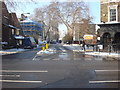
4

A40 flyover (Westway)
Crossrail construction in front.
Image: © N Chadwick
Taken: 22 Feb 2014
0.03 miles
5
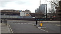
Tavistock Road, Westbourne Park
Tavistock Road looking east, to the T-junction with Great Western Road. In the background is a concrete flyover built in the 1960s, which carries the A40 trunk road into Central London.
Image: © Malc McDonald
Taken: 23 Feb 2014
0.04 miles
6

Train Tracks, Westbourne Park
London Underground's Hammersmith & City line in front, with the main line into Paddington beyond.
Westbourne Park bus garage in the background. Definitely a public transport picture, this one.
Image: © Des Blenkinsopp
Taken: 7 Apr 2014
0.04 miles
7

Great Western Road crosses the Great Western Railway
Image: © Steve Daniels
Taken: 25 Jun 2012
0.04 miles
9
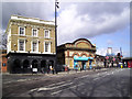
The Station & The Metropolitan
The line between Paddington and Hammersmith, including Westbourne Park station, was opened in 1864 by the Metropolitan Railway.
It retained its status as a branch of the Metropolitan line until 1990 when it was re-branded as part of the Hammersmith & City Line. (Info. Wiki. http://en.wikipedia.org/wiki/Hammersmith_%26_City_line )
The pub stuck with the old name.
Image: © Des Blenkinsopp
Taken: 7 Apr 2014
0.04 miles
10

Benchmark on wall of Westbourne Park Station
The Ordnance Survey cut mark benchmark on the 8th and 9th brick courses above the pavement and left of the downpipe is described on the Bench Mark Database at http://www.bench-marks.org.uk/bm38018
Image: © Roger Templeman
Taken: 20 May 2011
0.05 miles