IMAGES TAKEN NEAR TO
Woodbury Park Road, LONDON, W13 8DD

Introduction

This page details the photographs taken nearby to Woodbury Park Road, W13 8DD by members of the Geograph project.

The Geograph project started in 2005 with the aim of publishing, organising and preserving representative images for every square kilometre of Great Britain, Ireland and the Isle of Man.

There are currently over 7.5m images from over14,400 individuals and you can help contribute to the project by visiting https://www.geograph.org.uk

Image Map


Images are licensed for reuse under creativecommons.org/licenses/by-sa/2.0
Notes
  • Clicking on the map will re-center to the selected point.
  • The higher the marker number, the further away the image location is from the centre of the postcode.

Image Listing (55 Images Found)

Images are licensed for reuse under creativecommons.org/licenses/by-sa/2.0
  • ...
Image
Details
Distance
1
Victorian block on Pitshanger Lane
The front is on Woodbury Park Road
Image: © David Howard Taken: 11 Jul 2015
0.02 miles
2
Avenue of plane trees, Pitshanger Park
Leading to the gate at the end of Woodbury Park Road.
Image: © Robin Webster Taken: 13 Oct 2012
0.04 miles
3
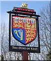
Sign for the Duke of Kent public house, Ealing
Image: © JThomas Taken: 13 Apr 2019
0.06 miles
4
The Duke of Kent public house, Ealing
On Scotch Common, West Ealing, London.
Image: © JThomas Taken: 13 Apr 2019
0.06 miles
5
The Duke of Kent
A Fullers pub on Scotch Common, Ealing.
Image: © Trevor Harris Taken: 12 Jul 2014
0.06 miles
6
The Duke of Kent, Scotch Common, 2012
Undergoing refurbishment here, looking like its pub days were over, but not so. A grade II listed building, these front parts built 1929 as the Kent Hotel, the name changed in 2003.
Image: © Robin Webster Taken: 13 Oct 2012
0.06 miles
7
North Ealing: Pitshanger Park
Pitts' Hanger, as it is shown on the Ordnance Survey map of 1868, was a farm that was eventually demolished in 1908 during the wholesale residential development that occurred in this area around that time. The name is remembered in Pitshanger Lane and in this park development in the former fields of the farm. Certainly the layout of this park is shown in the Ordnance Survey map of 1920. The trees either side of the avenue are London planes.
Image: © Nigel Cox Taken: 10 Oct 2008
0.07 miles
8
Pitshanger Lane
Image: © Des Blenkinsopp Taken: 25 Jun 2013
0.08 miles
9
Templewood at the junction of Kent Gardens
Image: © David Howard Taken: 11 Jul 2015
0.11 miles
10
Curzon Road, Perivale
Attractive early 20th century terraced houses with a lot of decorative features. Parking looks to be troublesome.
Image: © Des Blenkinsopp Taken: 25 Jun 2013
0.11 miles
  • ...