IMAGES TAKEN NEAR TO
Eastcote Avenue, GREENFORD, UB6 0NG
Introduction
This page details the photographs taken nearby to Eastcote Avenue, UB6 0NG by members of the Geograph project.
The Geograph project started in 2005 with the aim of publishing, organising and preserving representative images for every square kilometre of Great Britain, Ireland and the Isle of Man.

There are currently over 7.5m images from over14,400 individuals and you can help contribute to the project by visiting https://www.geograph.org.uk
Image Map
Images are licensed for reuse under creativecommons.org/licenses/by-sa/2.0
Notes
- Clicking on the map will re-center to the selected point.
- The higher the marker number, the further away the image location is from the centre of the postcode.
Image Listing (61 Images Found)
Images are licensed for reuse under creativecommons.org/licenses/by-sa/2.0
Image
Details
Distance
1
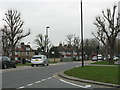
Sudbury - Whitton Avenue East
Taken from Allendale Road.
Image: © Peter Whatley
Taken: 7 Apr 2010
0.03 miles
4
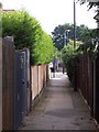
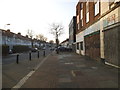
Alley - Sudbury Town
Eastcote Ave leading to Sudbury Heights Ave
Image: © Russell Trebor
Taken: 17 Jun 2006
0.06 miles
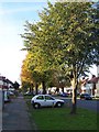
5
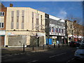
Eastcote Avenue, Sudbury
By the derelict snooker club
Image: © David Howard
Taken: 11 Mar 2014
0.06 miles
6
Derelict snooker club on Allendale Road
Image: © David Howard
Taken: 11 Mar 2014
0.08 miles

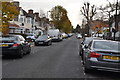
8
Whitton Ave - Sudbury Town
Whitton Ave/Whitton Drive
Image: © Russell Trebor
Taken: 29 Oct 2006
0.09 miles
9
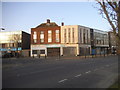
Sudbury: Former Odeon cinema, Allendale Road
Not knowing Sudbury I ventured down Allendale Road and thought I would take a photograph of the parade of shops. Looking for the best sun angle I went to the far end and spotted this building, which has been in use as a snooker club, and, despite the somewhat out of the way location, thought that it looked like a former cinema. Back home a Google search rapidly revealed that this was indeed the case and what's more is that there are comprehensive photographs of it in its hey-day on the English Heritage website. One of the photographs, taken in 1935, the year of its opening, reveals a magnificent semi-circular frontage set behind the current glass panelling here http://viewfinder.english-heritage.org.uk/search/reference.aspx?uid=107858&index=0&mainQuery=sudbury&searchType=all&form=basic&theme=&county=&district=&placeName= This shows the building from the opposite direction. However satellite imagery of the roof shows that the top of this facade is still in place. The cinema was "short-lived" according to another source on the internet, which, given its tucked-away location, is hardly surprising.
Image: © Nigel Cox
Taken: 2 Jan 2010
0.09 miles
10
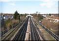
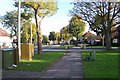
Piccadilly Line in Sudbury (3)
The houses in Sudbury Heights Avenue are to the left while those in District Road are to the right, with the image taken from the footbridge carrying the footpath between them over the railway. Another such footpath footbridge is in the distance. The footpaths actually predate both the railway and the houses as is evidenced by Victorian Ordnance Survey maps which show a network of footpaths radiating from the then hamlet of Sudbury.
Image: © Nigel Cox
Taken: 2 Jan 2010
0.09 miles