Piccadilly Line in Sudbury (3)
Introduction
The photograph on this page of Piccadilly Line in Sudbury (3) by Nigel Cox as part of the Geograph project.
The Geograph project started in 2005 with the aim of publishing, organising and preserving representative images for every square kilometre of Great Britain, Ireland and the Isle of Man.

There are currently over 7.5m images from over 14,400 individuals and you can help contribute to the project by visiting https://www.geograph.org.uk
Piccadilly Line in Sudbury (3)
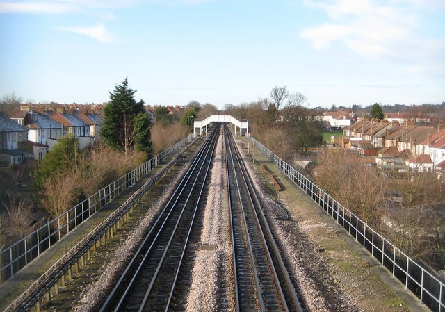
Image: © Nigel Cox Taken: 2 Jan 2010
The houses in Sudbury Heights Avenue are to the left while those in District Road are to the right, with the image taken from the footbridge carrying the footpath between them over the railway. Another such footpath footbridge is in the distance. The footpaths actually predate both the railway and the houses as is evidenced by Victorian Ordnance Survey maps which show a network of footpaths radiating from the then hamlet of Sudbury.
Images are licensed for reuse under creativecommons.org/licenses/by-sa/2.0
Image Location
Latitude
51.553038
Longitude
-0.321072