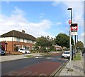
IMAGES TAKEN NEAR TO
Gauntlett Close, NORTHOLT, UB5 5TQ

Introduction

This page details the photographs taken nearby to Gauntlett Close, UB5 5TQ by members of the Geograph project.

The Geograph project started in 2005 with the aim of publishing, organising and preserving representative images for every square kilometre of Great Britain, Ireland and the Isle of Man.

There are currently over 7.5m images from over14,400 individuals and you can help contribute to the project by visiting https://www.geograph.org.uk

Image Map


Images are licensed for reuse under creativecommons.org/licenses/by-sa/2.0
Notes
  • Clicking on the map will re-center to the selected point.
  • The higher the marker number, the further away the image location is from the centre of the postcode.

Image Listing (10 Images Found)

Images are licensed for reuse under creativecommons.org/licenses/by-sa/2.0
Image
Details
Distance
1
Islip Manor Road
Unlikely as it may seem, this is part of a waymarked walk called the Dog Rose Ramble.
Image: © Des Blenkinsopp Taken: 9 Oct 2014
0.07 miles
2
Bus stop and terminus, Islip Manor Road, Northolt
This is a terminal stop for the E10 route, which ends at Ealing Broadway
Image: © MrC Taken: 19 Jun 2009
0.14 miles
3
Slip road to A40, Northolt
Slip road to westbound carriageway of A40, near to the junction with Islip Manor Road.
Image: © MrC Taken: 19 Jun 2009
0.18 miles
4
A40 - Islip Manor Road footbridge
Image: © Peter Whatley Taken: 12 Apr 2011
0.20 miles
5
Low Emission Zone reminder road sign at Northolt
The London Low Emission Zone covers most of Greater London. This reminder on the A40 is well inside the zone. "The Low Emission Zone (LEZ) was introduced in 2008 to encourage the most polluting heavy diesel vehicles driving in the Capital to become cleaner. The LEZ covers most of Greater London. To drive within it without paying a daily charge these vehicles must meet certain emissions standards that limit the amount of particulate matter (a type of pollution) coming from their exhausts." - quote from the Transport for London website.
Image: © David Hawgood Taken: 28 May 2012
0.21 miles
6
A40 - view west from the summit near Islip Manor Road
Image: © Peter Whatley Taken: 12 Apr 2011
0.21 miles
7
A40 at Northolt
View facing east, taken at end of Islip Manor Road.
Image: © MrC Taken: 19 Jun 2009
0.21 miles
8
Dog Rose Ramble - autumn colours at Manor Islip Park
The Dog Rose Ramble is an eight mile circular walk in the London Borough of Ealing which passes through different green spaces amid London suburbia.
Image: © Peter S Taken: 3 Nov 2019
0.21 miles
9
Footpath from A40 to Lime Tree Golf Course
Just yards from the busy A40 this path through small trees leads to the golf course, and on round the edge of the course to the A4180 Ruislip Road.
Image: © David Hawgood Taken: 28 May 2012
0.23 miles
10
Islip Manor Road joining Western Avenue
Image: © David Howard Taken: 10 Feb 2021
0.24 miles