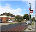
IMAGES TAKEN NEAR TO
Arnold Road, NORTHOLT, UB5 5TD

Introduction

This page details the photographs taken nearby to Arnold Road, UB5 5TD by members of the Geograph project.

The Geograph project started in 2005 with the aim of publishing, organising and preserving representative images for every square kilometre of Great Britain, Ireland and the Isle of Man.

There are currently over 7.5m images from over14,400 individuals and you can help contribute to the project by visiting https://www.geograph.org.uk

Image Map


Images are licensed for reuse under creativecommons.org/licenses/by-sa/2.0
Notes
  • Clicking on the map will re-center to the selected point.
  • The higher the marker number, the further away the image location is from the centre of the postcode.

Image Listing (4 Images Found)

Images are licensed for reuse under creativecommons.org/licenses/by-sa/2.0
Image
Details
Distance
1
New sports facilities
Image: © Alex McGregor Taken: 16 Aug 2013
0.15 miles
2
Railway west of Eastcote Lane bridge
On the left, the two Central Line tracks. On the right, two Network Rail tracks, one disused and overgrown. These are the route of the direct Great Western line to the north via High Wycombe and Banbury, whose passenger services are now very largely handled from Marylebone. The link from Marylebone joins this line at Northolt Junction just out of sight in the distance.
Image: © Robin Webster Taken: 6 Oct 2012
0.22 miles
3
Low Emission Zone reminder road sign at Northolt
The London Low Emission Zone covers most of Greater London. This reminder on the A40 is well inside the zone. "The Low Emission Zone (LEZ) was introduced in 2008 to encourage the most polluting heavy diesel vehicles driving in the Capital to become cleaner. The LEZ covers most of Greater London. To drive within it without paying a daily charge these vehicles must meet certain emissions standards that limit the amount of particulate matter (a type of pollution) coming from their exhausts." - quote from the Transport for London website.
Image: © David Hawgood Taken: 28 May 2012
0.23 miles
4
Islip Manor Road
Unlikely as it may seem, this is part of a waymarked walk called the Dog Rose Ramble.
Image: © Des Blenkinsopp Taken: 9 Oct 2014
0.25 miles