IMAGES TAKEN NEAR TO
White Lodge Close, ISLEWORTH, TW7 6TR
Introduction
This page details the photographs taken nearby to White Lodge Close, TW7 6TR by members of the Geograph project.
The Geograph project started in 2005 with the aim of publishing, organising and preserving representative images for every square kilometre of Great Britain, Ireland and the Isle of Man.

There are currently over 7.5m images from over14,400 individuals and you can help contribute to the project by visiting https://www.geograph.org.uk
Image Map
Images are licensed for reuse under creativecommons.org/licenses/by-sa/2.0
Notes
- Clicking on the map will re-center to the selected point.
- The higher the marker number, the further away the image location is from the centre of the postcode.
Image Listing (153 Images Found)
Images are licensed for reuse under creativecommons.org/licenses/by-sa/2.0
Image
Details
Distance
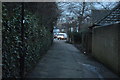
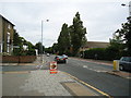
4
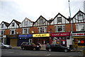
Isleworth - Newly Built Terrace Houses on White Lodge Close
Wikipedia : https://en.wikipedia.org/wiki/Isleworth
Image: © James Emmans
Taken: 13 Nov 2016
0.05 miles
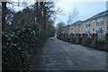
5
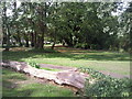
Silverhall Park, Isleworth
This small park in Isleworth lies alongside the Duke of Northumberland's River which runs through the trees on the right.
Image: © Marathon
Taken: 22 Sep 2010
0.06 miles
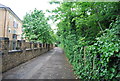
7
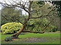
Mulberry tree, Silverhall Park, Old Isleworth
There are plenty of old trees in this little park, but this one caught my eye from a distance - like an over-sized bonsai. I was puzzled as to the species, but a local resident was able to identify it as a Black Mulberry.
Silverhall Park is a fairly narrow open space lying along the south side of the Duke of Northumberland's River. The area was once part of the grounds of a 17th century house known as Silver Hall. http://www.hounslow.info/libraries/local-history-archives/an-a-z-of-isleworth/an-a-z-of-isleworth-3/
Image: © Stefan Czapski
Taken: 1 Jan 2013
0.07 miles
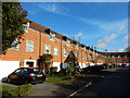
10
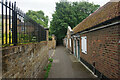
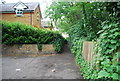
Mill Plat
A walkway linking Twickenham Road with the River Thames in Isleworth. On the right are Sir Thomas Ingrams Almshouses, now facing a lot of new development to the left.
Image: © Bill Boaden
Taken: 26 May 2022
0.09 miles