1
Rocks at the Road Junction
A small triangle of grass where Park Close meets Park Road. A bit of a feature, and stops people driving over the grass.
Image: © Des Blenkinsopp
Taken: 8 Jan 2019
0.12 miles
2
Hounslow Avenue Allotments
These allotments are located at the end of Hounslow Avenue in Hounslow in the London Borough of Hounslow.
Image: © Marathon
Taken: 9 Feb 2011
0.15 miles
3
Hounslow Avenue Allotments
Located at the end of Hounslow Avenue in Hounslow in the London Borough of Hounslow.
Image: © Marathon
Taken: 9 Feb 2011
0.15 miles
4
Houses on Whitton Dene
If anyone wants to know what the majority of Middlesex residential roads look like from here to Edgware this is a standard example.
Image: © David Howard
Taken: 27 Apr 2013
0.16 miles
5
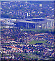
Hounslow and Twickenham Stadium from the air
The allotments at Hounslow Avenue are in the foreground. Viewed from a Prague bound flight from Heathrow.
Image: © Thomas Nugent
Taken: 10 Apr 2011
0.19 miles
6
Hounslow and Twickenham Stadium from the air
Viewed from a Prague bound flight from Heathrow.
Image: © Thomas Nugent
Taken: 10 Apr 2011
0.19 miles
7
Mogden sewage works and Twickenham Stadium from the air
Only part of the sewage works is visible. Viewed from a Prague bound flight from Heathrow.
Image: © Thomas Nugent
Taken: 10 Apr 2011
0.19 miles
8
Twickenham Stadium and the Thames from the air
The Strawberry Vale stretch of the Thames can be seen in the distance. Viewed from a Prague bound flight from Heathrow.
Image: © Thomas Nugent
Taken: 10 Apr 2011
0.19 miles
9
Sunset over Isleworth
Gainsborough Gardens at the junction of Hall Road
Image: © David Howard
Taken: 25 Jan 2014
0.19 miles
10
Whitton Dene
Whitton Dene is one of the too-many British roads of a T shape or more complex. The mini-roundabout is at the first junction of the left turn, still called Whitton Dene, and followed shortly by a second left turn of the same name which joins the other in a Y shape and continues on. The known record was Tracey Street in Southwark which was in four different sections, but was renamed in around the 1990s.
Image: © David Howard
Taken: 27 Apr 2013
0.22 miles


