IMAGES TAKEN NEAR TO
TW17 8TS
Introduction
This page details the photographs taken nearby to TW17 8TS by members of the Geograph project.
The Geograph project started in 2005 with the aim of publishing, organising and preserving representative images for every square kilometre of Great Britain, Ireland and the Isle of Man.

There are currently over 7.5m images from over14,400 individuals and you can help contribute to the project by visiting https://www.geograph.org.uk
Image Map
Images are licensed for reuse under creativecommons.org/licenses/by-sa/2.0
Notes
- Clicking on the map will re-center to the selected point.
- The higher the marker number, the further away the image location is from the centre of the postcode.
Image Listing (67 Images Found)
Images are licensed for reuse under creativecommons.org/licenses/by-sa/2.0
Image
Details
Distance
1
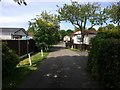
Halliford Park to Sunbury footpath in Grange Farm park homes zone
Recognised protected public path and access (static Park Home bungalows)
Image: © Ad-lad
Taken: 8 May 2020
0.01 miles
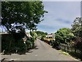
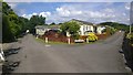
2
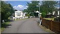
Keswick Avenue
Grange Farm Mobile home site
Image: © James Emmans
Taken: 27 Jun 2015
0.01 miles
3
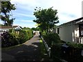
Pears Avenue
Residential path and only access (static Park Home bungalows)
Image: © Ad-lad
Taken: 8 May 2020
0.03 miles
4
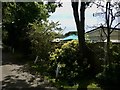
Hedge-and-tree verge or buffer in Grange Farm Estate between park homes
Exemplary planting between Stirling Avenue and the others - all host the mobile style of bungalows with own gardens
Image: © Ad-lad
Taken: 8 May 2020
0.05 miles
5
Bramley Avenue
Asphalt path between homes, their means of access.
Image: © Ad-lad
Taken: 8 May 2020
0.06 miles
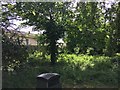
7
Upper Halliford recreation ground
The recreation ground on the Upper Halliford Road north of the village.
Image: © Alan Hunt
Taken: 24 Sep 2015
0.08 miles
8
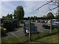
Grange Farm Estate car park
Residents can park bikes etc in their own plots, cars are parked in this somewhat landscaped car park. As with most car parks in Britain the surface is friendly to cars but not to trees and slowing run-off of the land being asphalt laid.
Image: © Ad-lad
Taken: 8 May 2020
0.08 miles
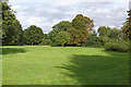
10
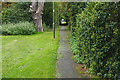
Footpath, Upper Halliford
The path from Upper Halliford Road along the south side of the recreation area to the Grange Farm estate.
Image: © Alan Hunt
Taken: 24 Sep 2015
0.09 miles