IMAGES TAKEN NEAR TO
Dickenson Road, FELTHAM, TW13 6SW
Introduction
This page details the photographs taken nearby to Dickenson Road, TW13 6SW by members of the Geograph project.
The Geograph project started in 2005 with the aim of publishing, organising and preserving representative images for every square kilometre of Great Britain, Ireland and the Isle of Man.

There are currently over 7.5m images from over14,400 individuals and you can help contribute to the project by visiting https://www.geograph.org.uk
Image Map
Images are licensed for reuse under creativecommons.org/licenses/by-sa/2.0
Notes
- Clicking on the map will re-center to the selected point.
- The higher the marker number, the further away the image location is from the centre of the postcode.
Image Listing (26 Images Found)
Images are licensed for reuse under creativecommons.org/licenses/by-sa/2.0
Image
Details
Distance
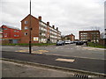
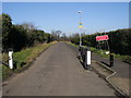
1
Nallhead Road from the corner of Dickenson Road
Image: © David Howard
Taken: 14 Apr 2013
0.04 miles
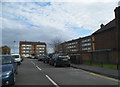
3
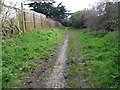
Bridle path from Hanworth to Kempton Park
Image: © David Howard
Taken: 14 Apr 2013
0.05 miles
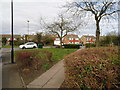
7
Church Road
Church Road down to the then closed footbridge over the A316
Image: © Shaun Ferguson
Taken: 15 Feb 2013
0.10 miles
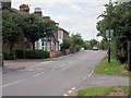
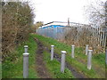
8
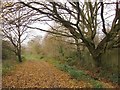
Bridleway by Kempton Reservoir
Unlikely though it may seem in this suburban area, no public motor road runs through this grid-square - though the A316 just grazes its north-west corner. The main public access to the area is by means of this bridleway, signposted off Nallhead Road, Hanworth. It is well-used by riders, and tends to get very muddy later in the winter season.
Much of the grid-square is (or was until fairly recently) occupied by reservoirs and water-treatment works. The largest of the original basins - to the east of the bridleway - has now been landscaped and has become a nature reserve (managed by Thames Water). Though of a fair size, Kempton Park East was nonetheless much smaller than the later reservoirs further west - Queen Mary, King George VI and Staines, for instance.
The south-west corner of the square falls within the Kempton Park Racecourse estate.
Image: © Stefan Czapski
Taken: 14 Dec 2013
0.13 miles