IMAGES TAKEN NEAR TO
Queens Road, TEDDINGTON, TW11 0ND
Introduction
This page details the photographs taken nearby to Queens Road, TW11 0ND by members of the Geograph project.
The Geograph project started in 2005 with the aim of publishing, organising and preserving representative images for every square kilometre of Great Britain, Ireland and the Isle of Man.

There are currently over 7.5m images from over14,400 individuals and you can help contribute to the project by visiting https://www.geograph.org.uk
Image Map
Images are licensed for reuse under creativecommons.org/licenses/by-sa/2.0
Notes
- Clicking on the map will re-center to the selected point.
- The higher the marker number, the further away the image location is from the centre of the postcode.
Image Listing (103 Images Found)
Images are licensed for reuse under creativecommons.org/licenses/by-sa/2.0
Image
Details
Distance
1
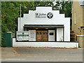
St John Ambulance - Teddington headquarters
On Park Road.
Image: © Robin Webster
Taken: 16 Sep 2012
0.07 miles
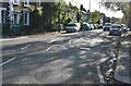
2
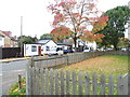
Park Way Stables, Teddington
The last remaining stables in London are usually in fields, this is on a residential road.
Image: © David Howard
Taken: 27 Oct 2013
0.09 miles
3
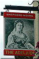
The Adelaide inn sign
For the rest of the pub, see Image
Image: © Robin Webster
Taken: 16 Sep 2012
0.11 miles
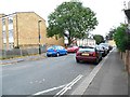
5
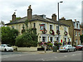
The Adelaide, Teddington
A Shepherd Neame pub on the corner of Albert Road, although curiously Adelaide Road is the next block up.
Image: © Robin Webster
Taken: 16 Sep 2012
0.11 miles
7
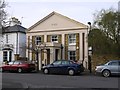
Converted chapel. Clarence Road, Teddington
This building isn't listed in my 1951 copy of the Middlesex volume of 'The Buildings of England'. But you can imagine what old Professor Pevsner would have to say - something like: 'Minimally classical. Pediment, pilasters and portico devoid of detail and not referable to any one or other of the orders'.
The windows are entirely domestic in style (and disposition) - perhaps the original arrangement was a single tall, arched window on either side of the entrance. The aerial view on Google confirms the chapel-like plan - the building extends much further back from the street than its neighbours.
The date on the pediment is 1859.
Image: © Stefan Czapski
Taken: 28 Feb 2013
0.14 miles
8
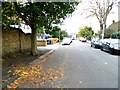
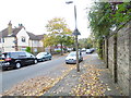
Park Lane, Teddington
Anyone looking for the Hilton Hotel will be disappointed, but Teddington is far nicer and has some good hotels very close by as well.
Image: © David Howard
Taken: 27 Oct 2013
0.14 miles
10
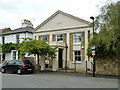
Former chapel, Clarence Road
Built 1859 as a Wesleyan Methodist chapel, it was vacated when the congregation got too large and rented in 1880 to the Baptists, who in turn moved on. Later it was called 'Craig Hall', which can just be made out on the original photograph above the date on the pediment. Now apparently a private house.
Image: © Robin Webster
Taken: 16 Sep 2012
0.15 miles